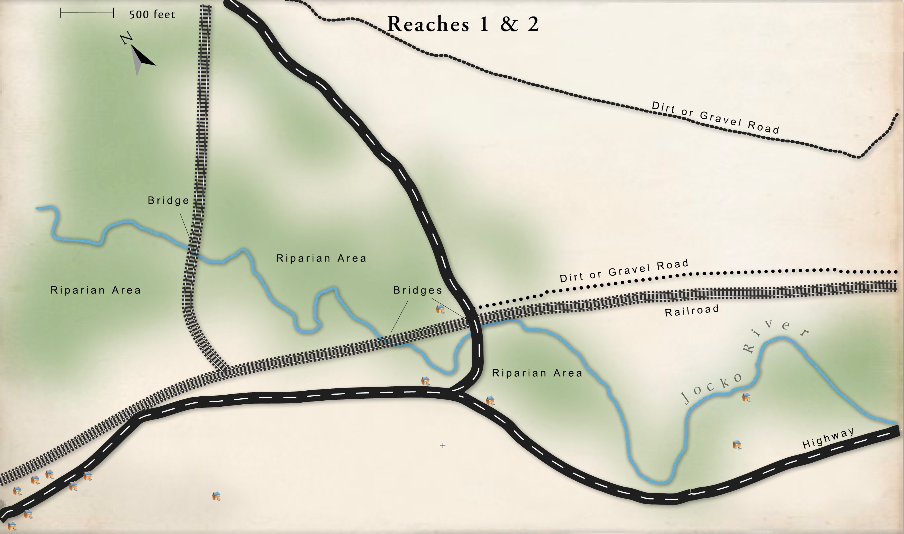
Bridges
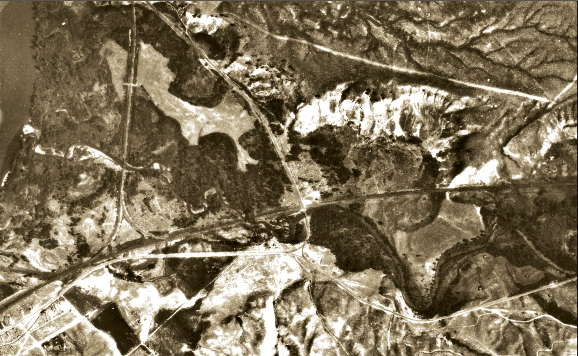
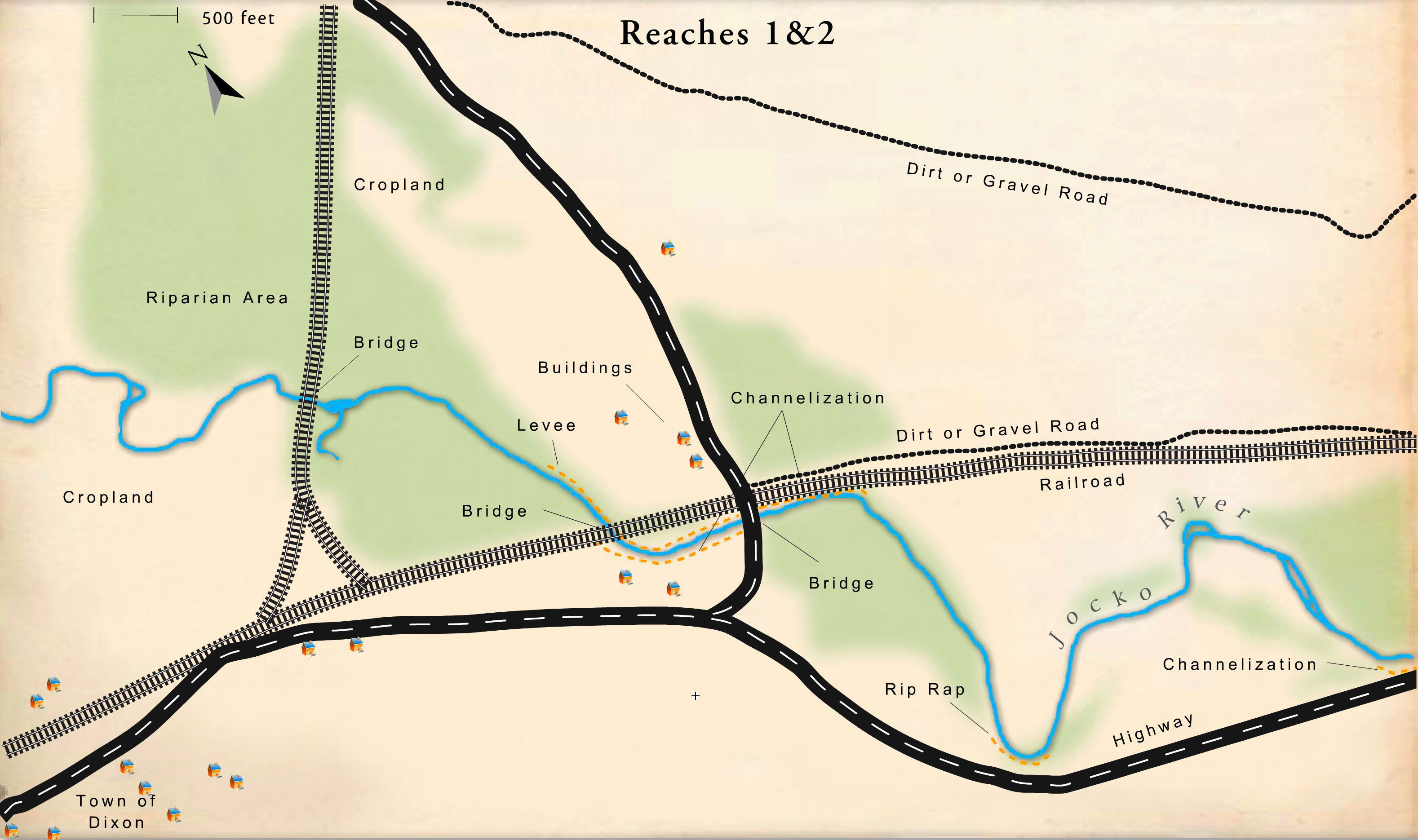
There are three bridges in this reach: 2 railroad and 1 highway. The most downstream railroad bridge con-stricts over-bank flood flows and shallow, alluvial groundwater. Because of its location, it has a significant influence on the river and its stability. The second bridge has only a minor impact on the river—there is some upstream bank erosion, pier scour, and there are sediment transport problems, and the bridge is located on a meander, which makes it more vulnerable to erosion and deposition, but overall, the impact is minor. The Highway 212 Bridge does not significantly affect the river.
Channelization
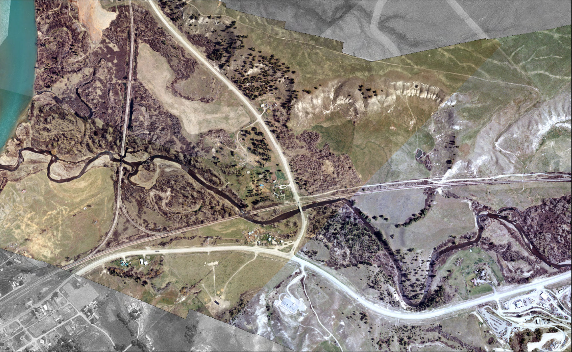
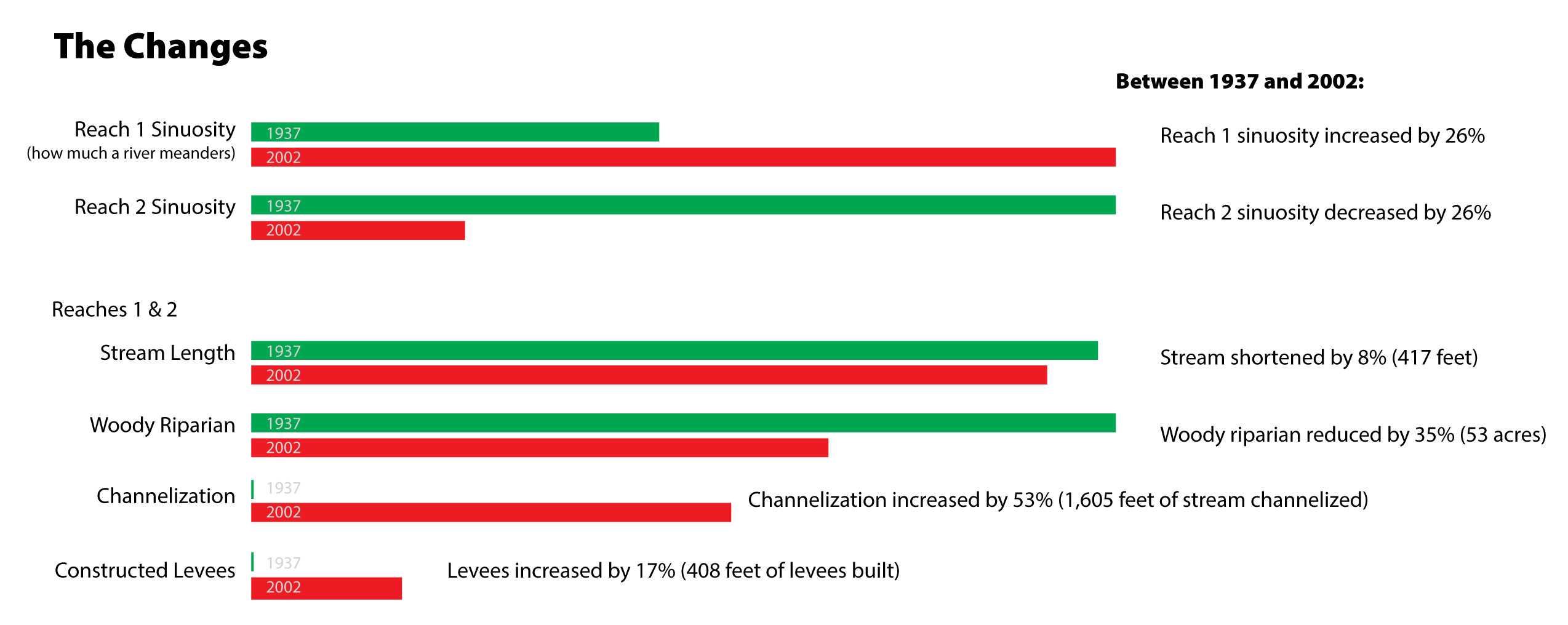
Fifty-five percent of Reach 2 has been channelized, and another 15 percent is affected by constructed levees. Some of the levees are constructed of vehicles cabled together. Although an individual feature like that may not influence overall channel stability, the cumulative effect of numerous channel confinement features can lead to reach-scale channel instability.
Homes
There are several houses on the floodplain in these two reaches, and there has been some channelization and riprapping to protect these structures and agricultural buildings from high water events. This has altered the hydrology of the river, reducing its access to the floodplain.
Riparian Habitat
In 1937, 75% and 59% of the floodplain of Reach 1 and 2 was covered by woody riparian vegetation, respectively. In 2002, those numbers had dropped to 41% and 47%. Much of the clearing was for agricultural purposes. In 2002, 30 percent of the floodplain of Reaches One and Two was agricultural land. In fact, the entire floodplain of Reach One south of the active channel has been converted to agricultural pasture. Riparian grazing along the southwest side of the channel in Reach Two has reduced
riparian vegetation densities which, in turn, has reduced bank stability, riparian habitat, and stream shading.
Roads
By 2002 a number of low-standard roads had been built within the flood-plain for agricultural and residential purposes. Roads adjacent to the channel intercept and divert overland flows and can separate the river from the floodplain. Unimproved roads can also add sediment to the river, whether or not they are in the floodplain.
Railroad
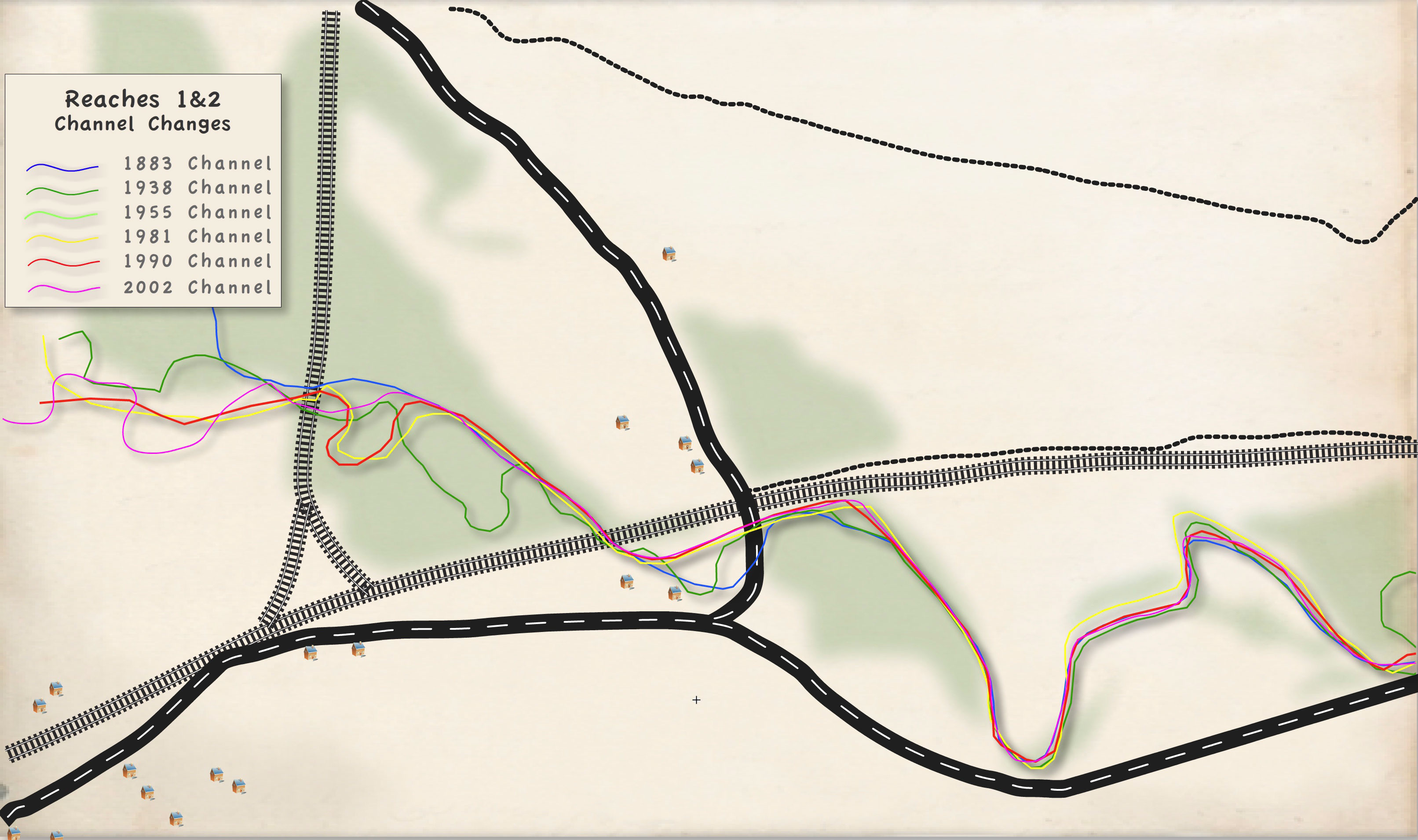
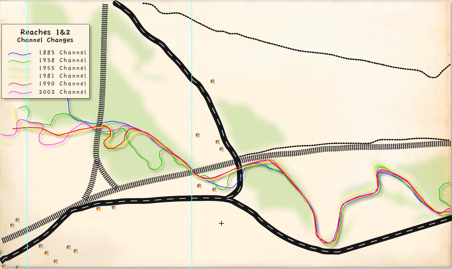
The railroad crossing marking the upstream extent of Reach 1, impacts the stability of the channel and floodplain. Floodplain fill for the railroad bed constricts the channel and disconnects the floodplain upstream and downstream of the grade. It confines flows to the channel and increases the floodplain surface-water elevation during flood events. It is likely that sediment deposition and debris accumulation occur upstream of the railroad crossing because it is undersized. In Reach 2, sediment deposition upstream of the railroad bridge may have contributed to a channel avulsion (an abrupt change in the course of a stream whereby the stream leaves its old channel for a new one). Although the channel has been shortened, the abandoned meander provides diverse off-channel habitats that benefit fish and waterfowl. The railroad bridge and raised railroad grade paralleling the channel in the upper half of the reach have also encroached on the floodplain and straightened the channel.
Other
Floodplain fill for the highway and railroad crossing abutments have converted the historical meandering stream type to a wider, shallower, and straighter stream type.