The Jocko Watershed
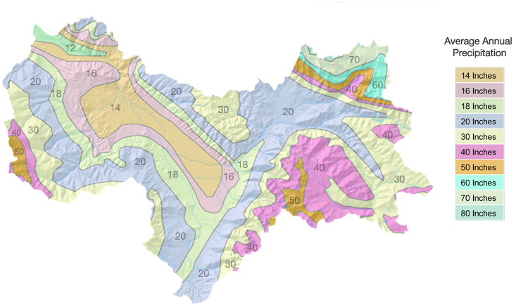
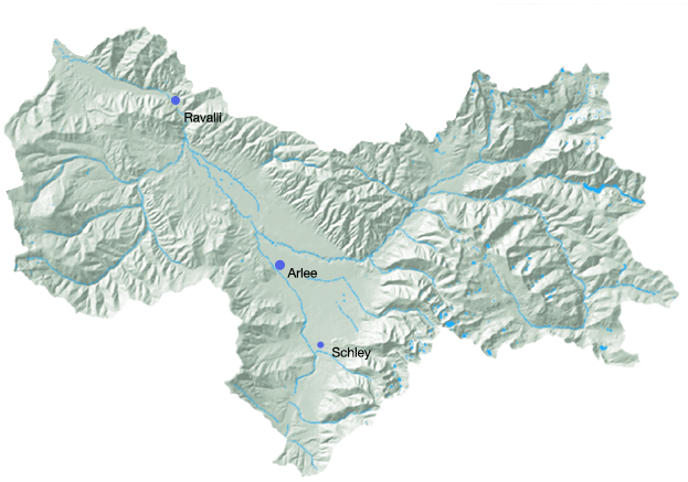
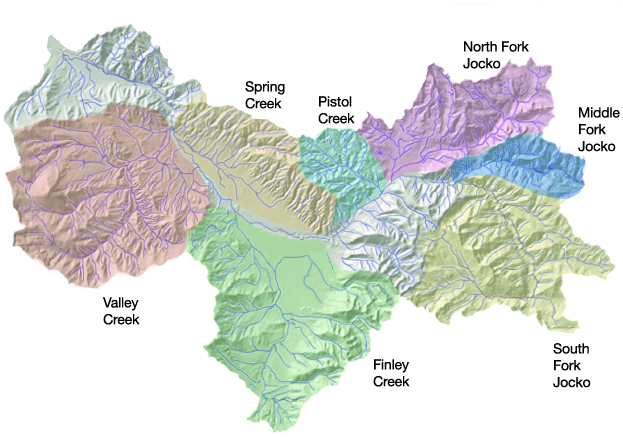
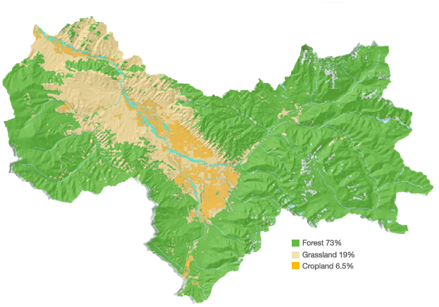
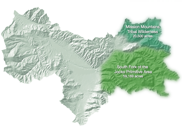
The Jocko River drainage basin is the second largest tributary watershed of the lower Flathead River in the Clark Fork River Basin. At its mouth, the Jocko has an annual average discharge of 238 cubic feet per second. The Jocko River drains a watershed area of 246,263 acres, with approximately 5% of the drainage under irrigation. The watershed includes the South Fork of the Jocko Primitive Area, the Pistol Creek Mountains, the Ninemile Divide area from Evaro to Valley Creek, and the communities of Arlee, Ravalli, and Evaro. Three headwater tributaries — the North, Middle, and South Forks — join to form the Jocko River. Below the confluence of the three forks, the river flows west to the town of Arlee. Above Arlee, it cuts through a confined valley and is high gradient, typical of mountain streams. Below Arlee, the Jocko flows north through the Jocko Valley and becomes less confined, flowing through a broad valley of forest, wetlands, and agricultural land. Finley and Valley Creeks flow into the Jocko below Arlee.