Bridges
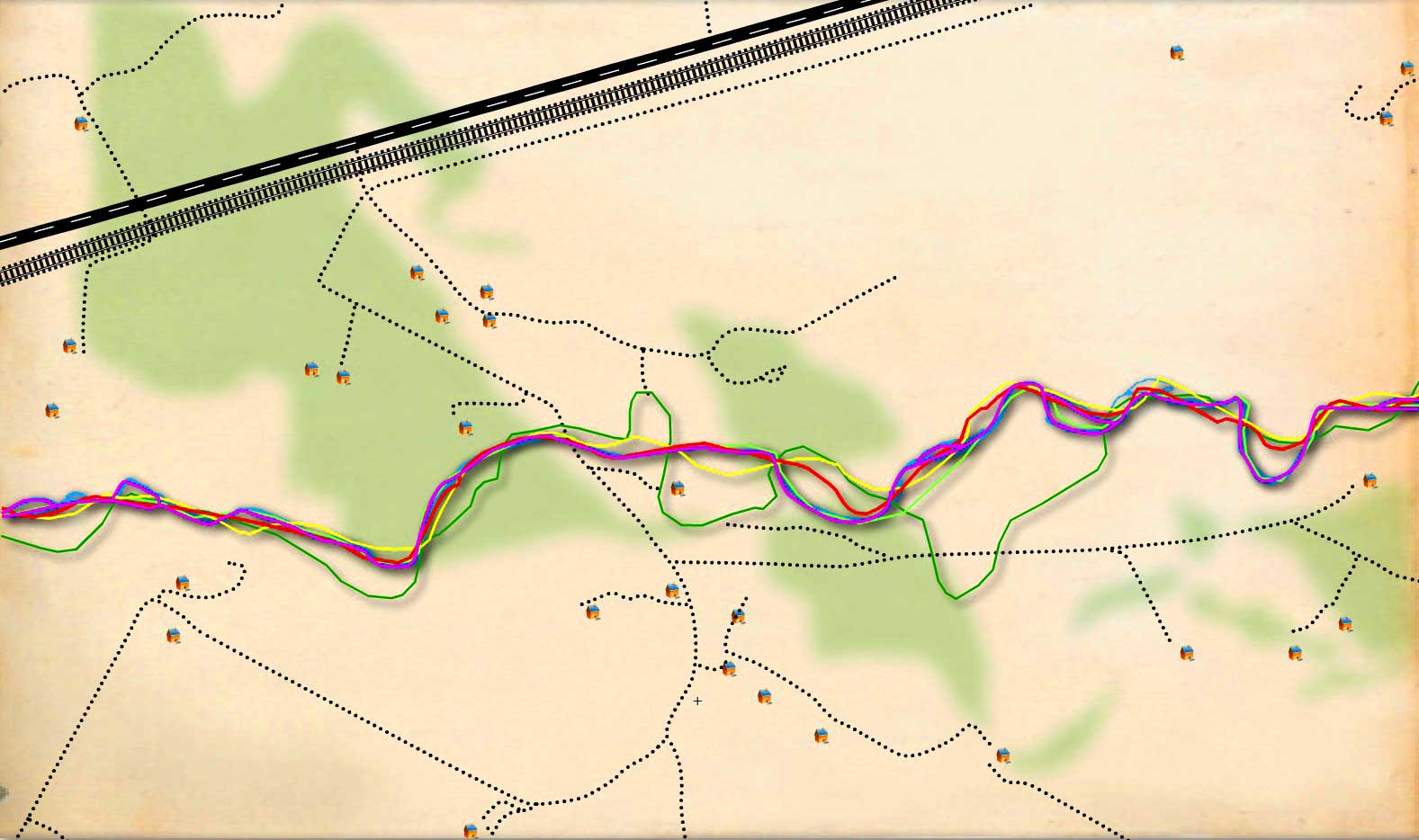
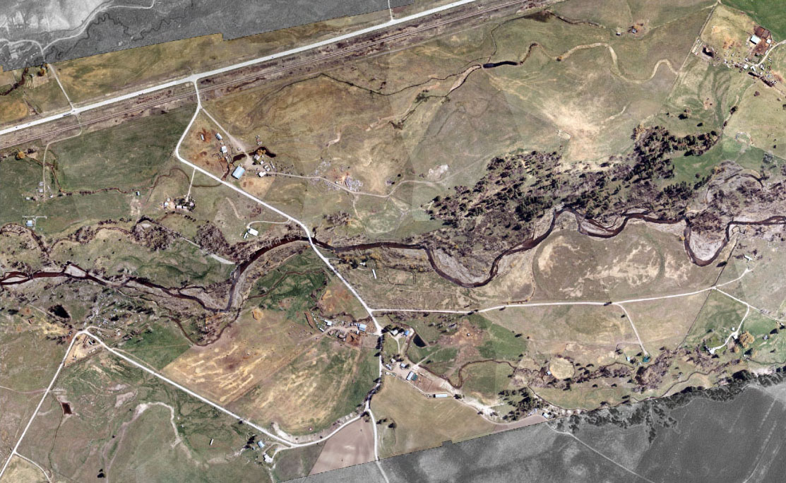
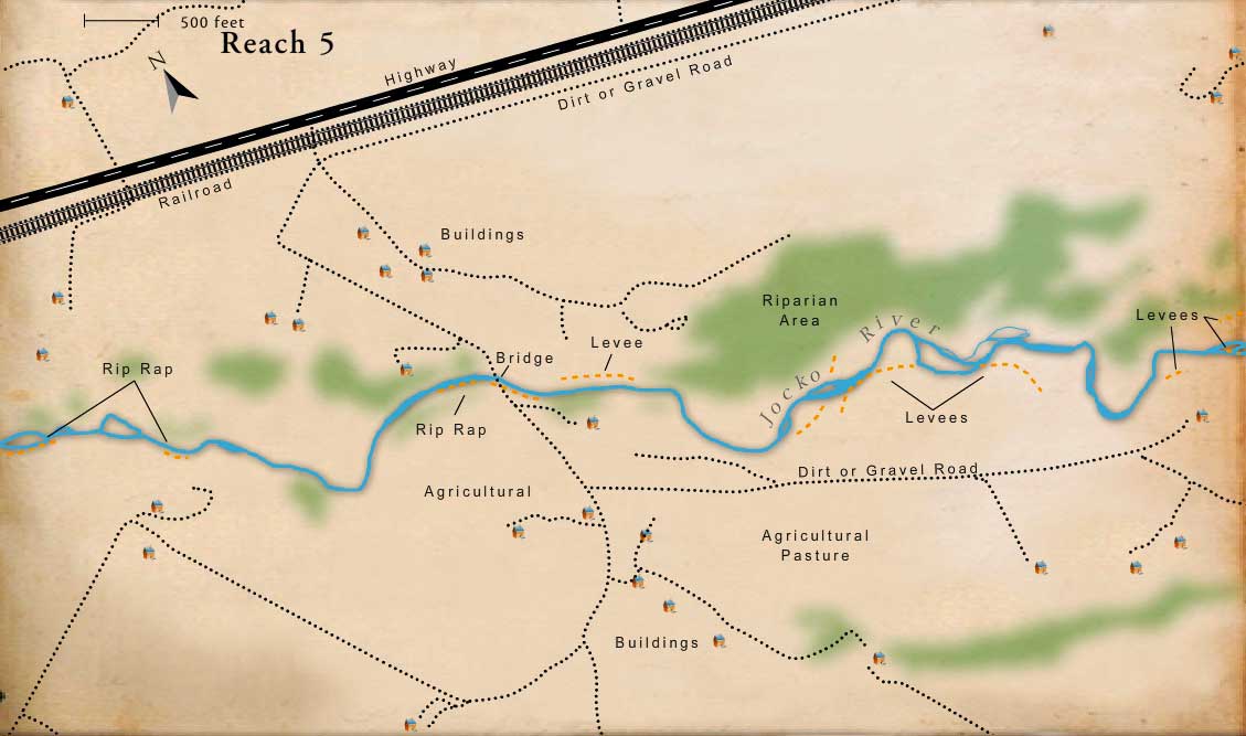
The South Valley Creek Road Bridge has created several problems, including bank erosion and abutment scour. Rip-rap has been dumped along the down-stream east bank. There is bank erosion on the east bank downstream of the rip-rap. For these reasons and because of significant floodplain constriction and backwater effects, this bridge has a major impact on the river.
Constructed Levees & Channelization
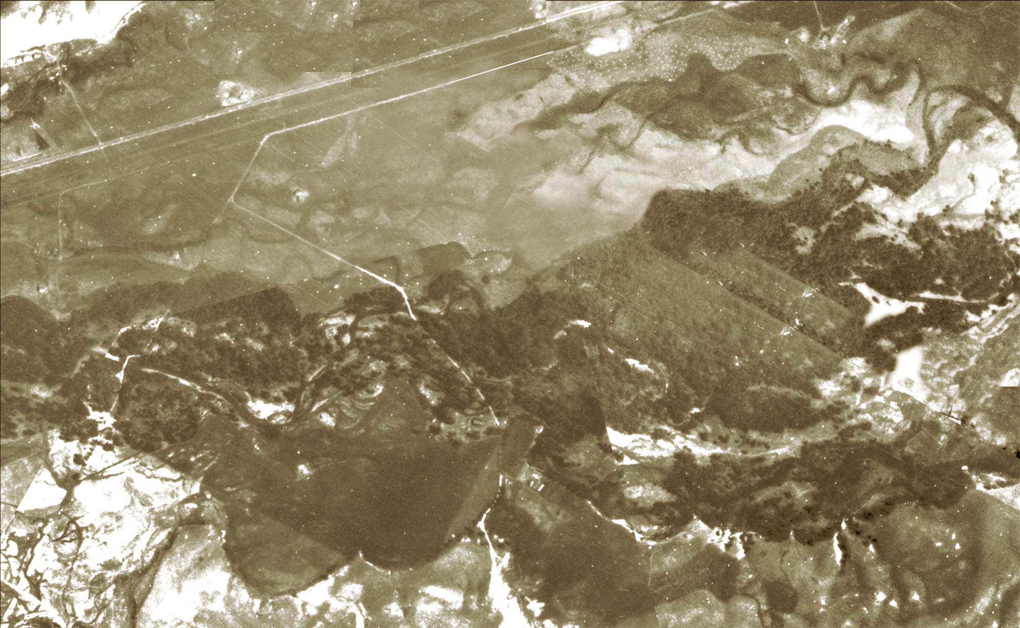
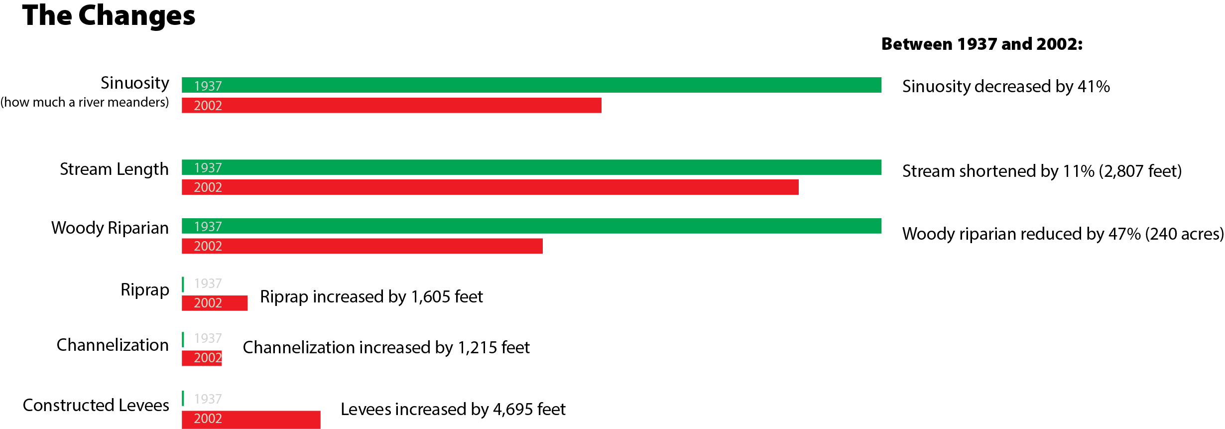
Ten percent of the banks in Reach 5 are riprapped, 5% of the length is channelized, and 20% is affected by constructed levees. The figure at left is an example of a levee system constructed of vehicles cabled together. Although an individual feature like this may not influence overall channel stability, the cumulative effect of numerous channel confinement features can lead to reach-scale channel instability.
Agriculture
In 2002, 64% of the floodplain of Reach Five was agricultural land, most of that land had been riparian. Loss of riparian vegetation has reduced bank stability, riparian habitat, and stream shading. In addition, floodplain hydrology has been altered by channelizing spring channels and reducing the inter-connectivity between the channel and the floodplain.
Homes
By 2002 a number of houses and agricultural buildings had been constructed in the floodplain. Impacts associated with this development include channelization, floodplain encroachment, and riparian vegetative clearing, all of which has had a substantial negative impact on the river and its fish and wildlife.
Riparian Habitat
In 2002, 18% of the floodplain of Reach 5 was covered by woody riparian vegetation, a loss of 47% since 1937. Riparian communities are among the most productive wildlife habitats and are key to healthy fish populations.
Roads
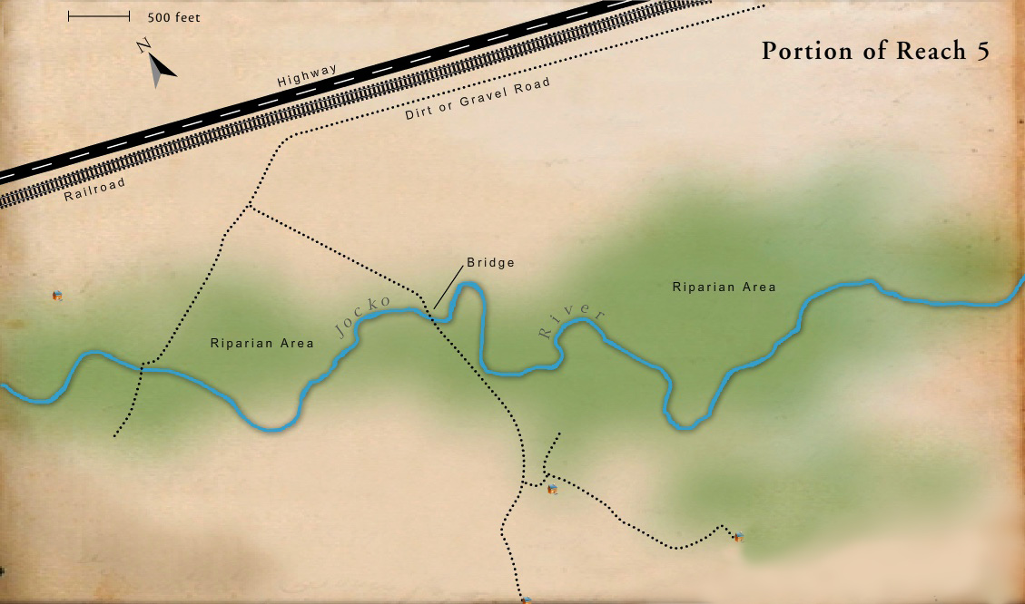
In places, the highway has separated the river from wetland and riparian communities on the floodplain (although in the short piece of Reach 5 shown here, the highway is a long distance from the river and has minimal impact). Isolating these areas interrupted important river processes vital to fish and wildlife.
Railroad
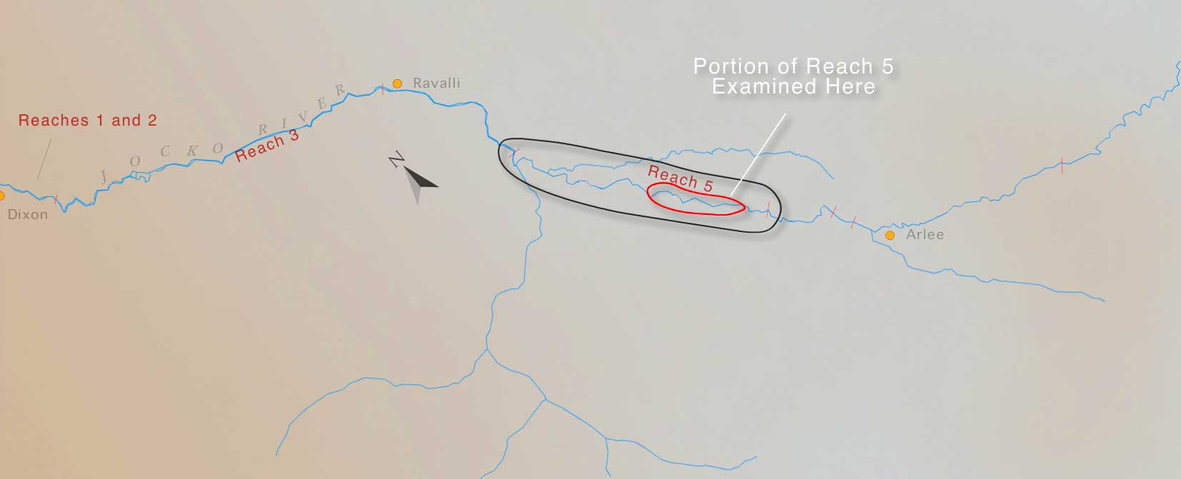
With the exception of the downstream end of Reach 5, the railroad is far enough away from the river so that it's impact on the channel is minimal. At the downstream end (down-stream from the area shown on this map), channelization for the railroad and highway has altered channel stability.