


Loading . . .
Interactive Map
Natural and Human History of the River
Interactive Map
The Natural and Human History of the
Lower Flathead River
Interactive Map
The Natural and Human History of the
Lower Flathead River
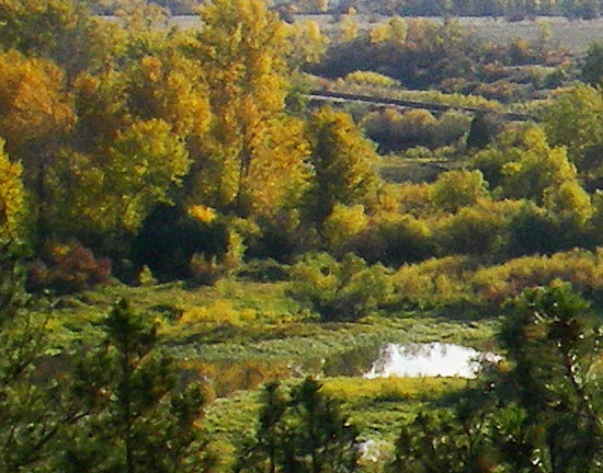
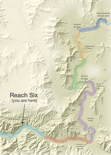
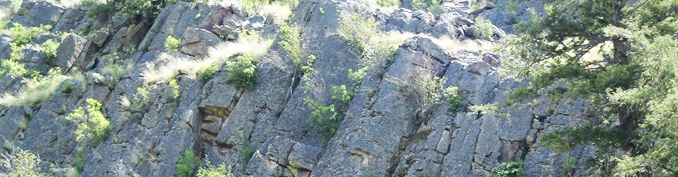
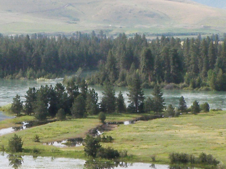
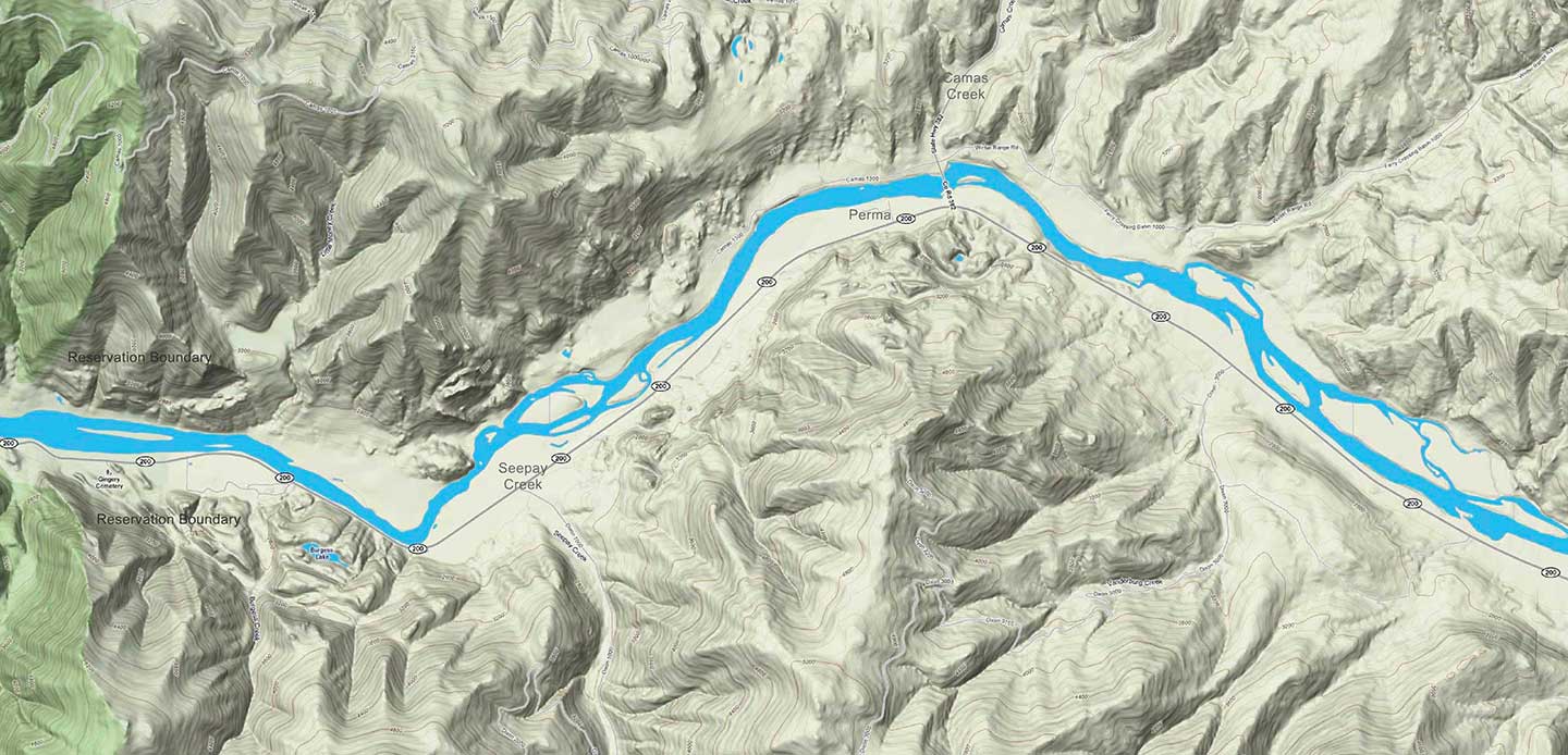
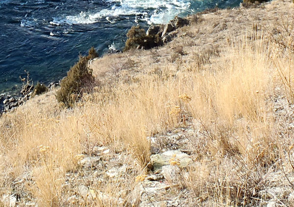
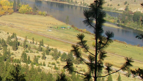
On this page you can explore River Reach Six, which runs from a point 9.3 miles downstream of Dixon to the Reservation Boundary. The river drops about 1.3 feet/mile. The river channel is braided, and there are major island complexes, gravel bars, and extensive backwater areas. The Perma Bridge crosses the river at Perma.
Reach Six
From a point 9.3 miles downstream of Dixon to the Reservation Boundary
Click a Map Pin
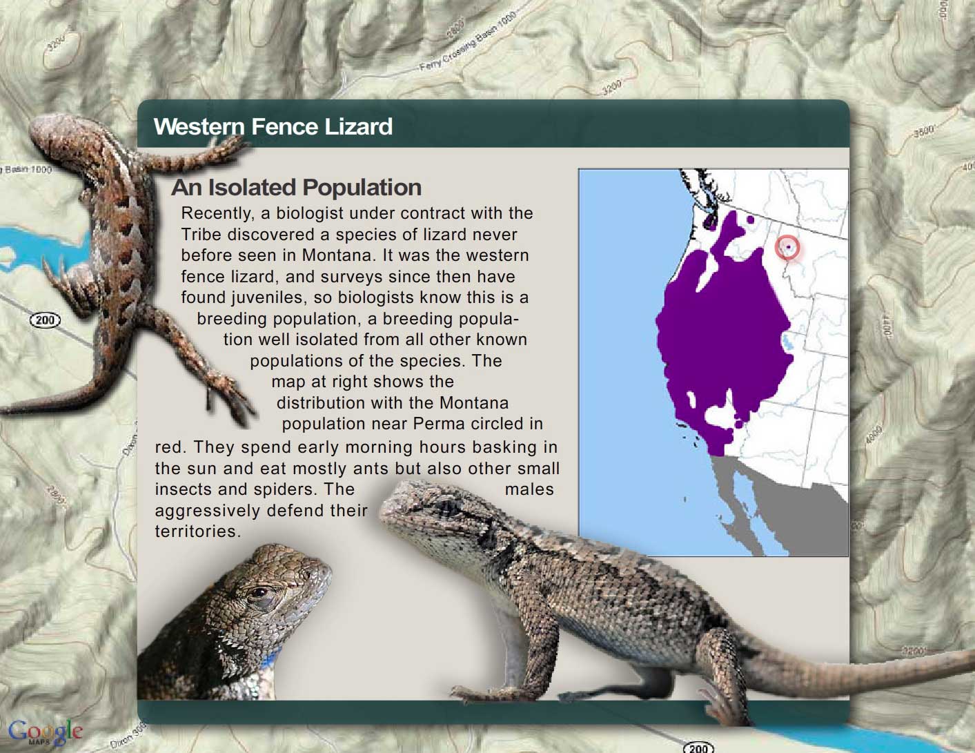
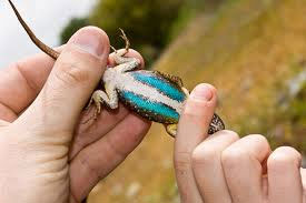
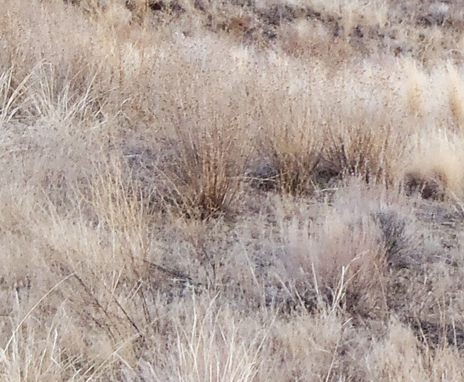
Fence Lizard


If you were to turn a fence lizard over and look at its belly, you would see two bright blue or turquoise patches on either size (one common name for the lizard is "blue-bellied lizard"). Like the canyon wren's song, these patches are used by males to warn off other males and to attract females (the male's patches become much brighter during breeding season).
Why do you think a bright blue belly on one male would scare away other males?
The map above shows the distribution of this lizard in the U.S. How do you account for one tiny population (circled in red) isolated so far from the rest of the population? How could such a population get started?
If you were to turn a fence lizard over and look at its belly, you would see two bright blue or turquoise patches on either size (one common name for the lizard is "blue-bellied lizard"). Like the canyon wren's song, these patches are used by males to warn off other males and to attract females (the male's patches become much brighter during breeding season).
Why do you think a bright blue belly on one male would scare away other males?
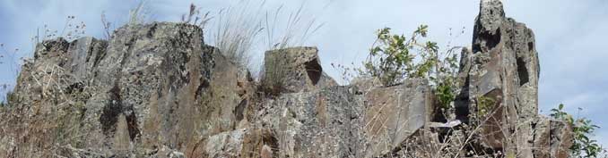
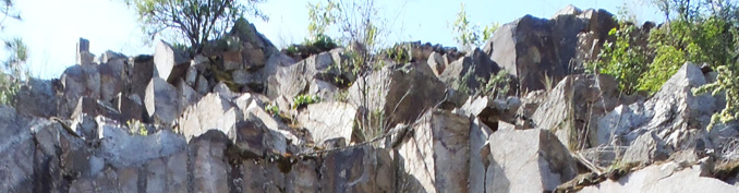
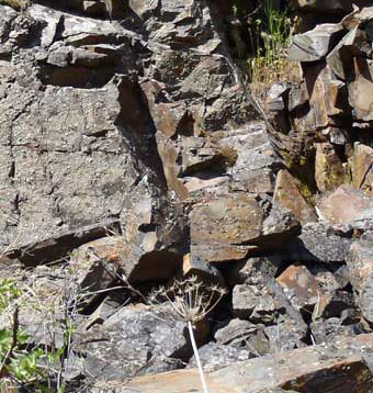
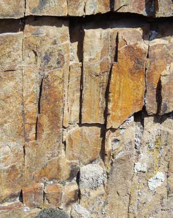
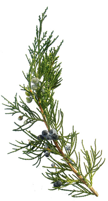
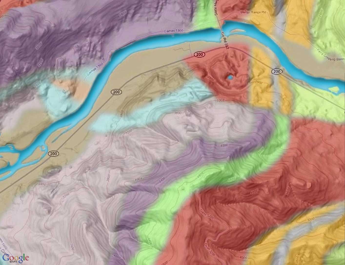
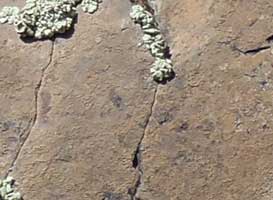
Perma Geology: Belt Supergroup Rocks and Igneous Sills

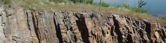
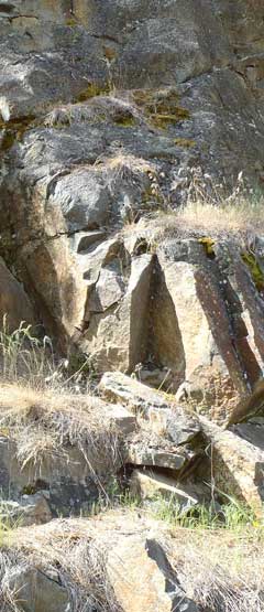
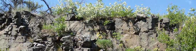
At Perma, igneous rocks (rocks that form from magma when it cools) intruded into the Belt rocks. These intrusions are known as sills, and Perma is the only place on the Reservation where they occur.
Click on the map markers below to learn more about geology in the Perma area.
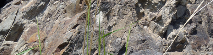
Prichard — Unit D
The Prichard Formation (along with most of the rocks of that underlie the Flathead Reservation) are part of what's called the Belt Supergroup. The Prichard Formation, which underlies most of the southwestern part of reservation is very old. The rocks formed about 1.4 billion years ago, when the earth was around 3 billion years old. For perspective, the earliest fossils of land plants appear in rocks that are about 450 million years old. They are a billion years younger than the Belt rocks. Dinosaurs show up in the fossil record 200 million years after land plants first appear, and humans come on the scene some 240 million years after that. To see how these events fit together, make a timeline.
The Prichard as a whole is about 4 miles deep. Unit D is just one section of the Prichard. It is about 1,500 to 2,400 feet thick and is made up of gray, rust-colored weathering, silty argillite containing abundant chlorite crystals (formed when iron combines with silica compounds) and sparse garnet (garnet are silicate minerals that are used as gemstones and abrasives).

Paradise Sill

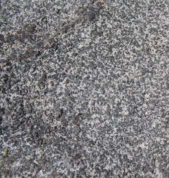
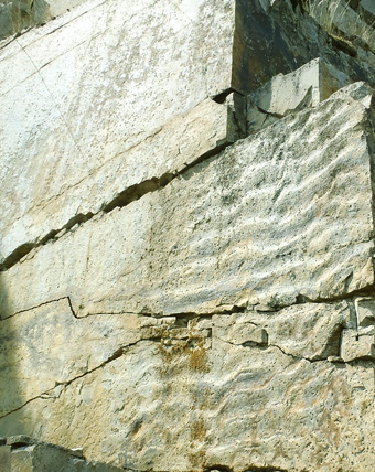
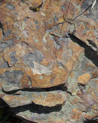
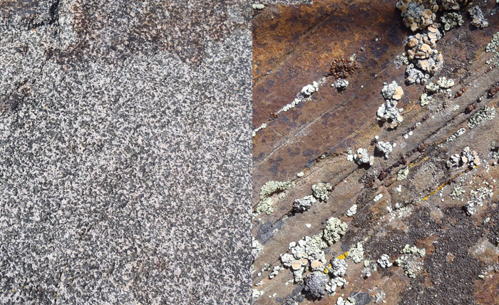
Most of the rocks on the Reservation, including those in the Perma area, are sedimentary rocks, which formed from layers of sediment like silt and clay and sand that accumulated on the bottom of an ancient inland sea. Over hundreds of millions of years, heat and pressure converted those sediments to rock. But there are also areas of igneous rocks—rocks that form from magma when it cools. That’s what the Paradise Sill is. Like other sills in the Perma area, it formed when magma rose up from below and forced itself between weak, easily penetrated, layers of rock or sediment. It is thought that the Paradise Sill magma intruded when the sediments were partly wet. The Paradise Sill, like other Perma sills, is a mafic rock, meaning it is high in magnesium and iron (in fact, the word mafic comes from combining the words magnesium (ma) and ferric (fic) (ferric means iron). When the rock is exposed, the iron oxidizes and gives the rock a reddish color.
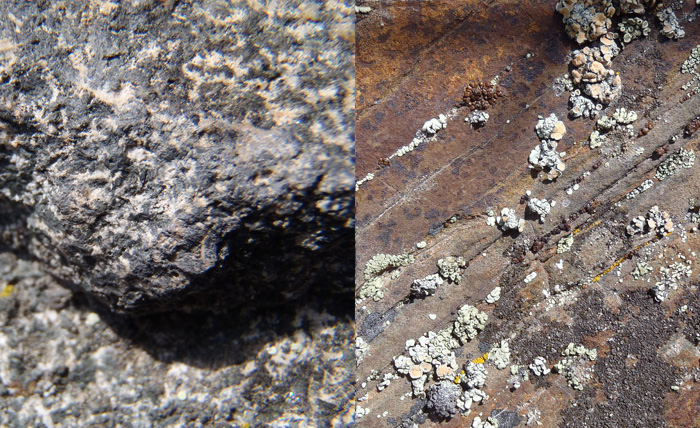
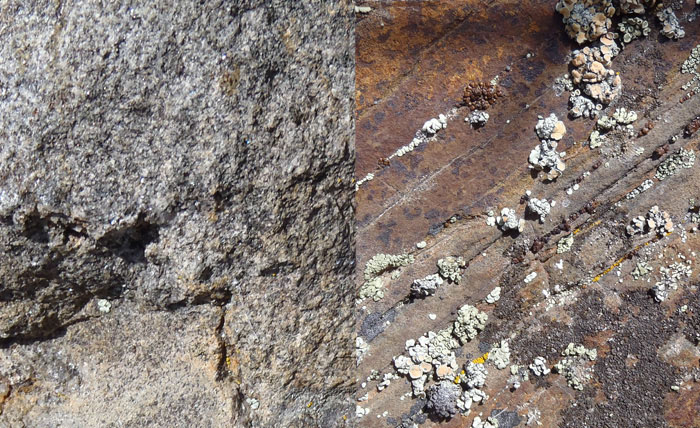
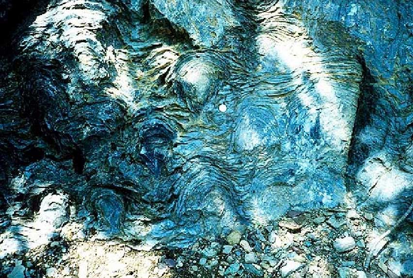
You can tell the difference between igneous rocks and sedimentary rocks in the Perma area because igneous rocks are uniformly made up of crystals (see photo top right) whereas sedimentary rocks are layered and composed of much finer particles of clay and silt and occasionally sand. The images (lower right) illustrate the difference.

Prichard — Unit B
The Prichard Formation (along with most of the rocks that underlie the Flathead Reservation) are part of what's called the Belt Supergroup. The Prichard Formation, which underlies most of the southwestern part of the reservation is very old.
The rocks formed about 1.4 billion years ago, when the earth was around 3 billion years old. For perspective, the earliest fossils of land plants appear in rocks that are about 450 million years old. They are a billion years younger than the Belt rocks. Dinosaurs show up in the fossil record 200 million years after land plants first appear, and humans come on the scene some 240 million years after that. To see how these events fit together, make a timeline. The Prichard as a whole is about 4 miles deep.
Unit B is just one section of the Prichard. It is about 1,500 to 3,000 feet thick and is made up of dark-gray siltite and light-gray argillite but it rusts when exposed to the weather so it has a rusty-redish color. (Argillite is a clay-rich rock. It is a hardened siltstone or shale (shale is simply hardened mud)).
.

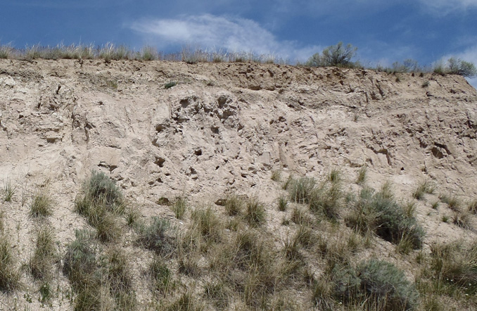
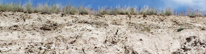
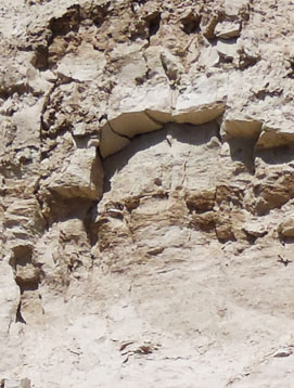
Surficial (Surface) Deposits

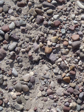
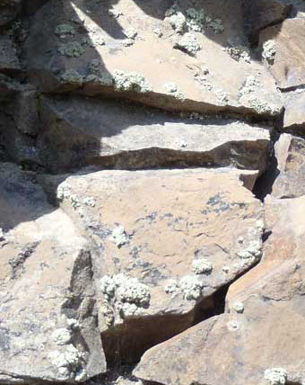
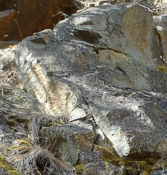
What geologists call surfical deposits refers to what lies on the surface, above the bedrock. In the Perma area, these deposits are mostly found in the valley bottom and are cut by the river. They are alluvium and lake deposits. Alluvim (top right) is gravel, sand, and minor amounts of silt that have been deposited over the past few thousand years by the river (see the top photo at right). The thickness of these deposits, ranges from a few inches to about 40 feet.
The other kind of surficial deposit, the lake or lacustrine deposits, are the thick layers of silts and clays that settled out of Glacial Lake Missoula during the last ice age (lower right and bottom photo). That ice age (known as the Pleistocene Ice Age) started about 2 million years ago and ended about 10,000 years ago. The sediments are tan colored and made up of many thin layers of silt and clay. They can be from 1 foot to more than 300 feet thick. In places farther upstream, such as near Sloans Bridge, it forms high cliffs. Near Perma, the deposits, cut by streams or roads might be 10 to 20 feet high. Cavity nesting birds often excavate holes in these banks. Where the deposits are lower, coyotes, foxes, and badgers and other mammals find good places for dens because the deposits make for easy digging, and the dens are relatively stable.

Empire Formation
The Empire Formation is gray to green and weathers to light green. The rock in the Empire is mostly argillite. Near Perma, the Empire Formation has grayish to very light green color. But elsewhere, like in Glacier National Park, it is more greenish. The greenness comes from a chemical process called reduction, the exact opposite of what occurs when iron rusts. The sediments—silt and clay—that would become the Empire Formation, settled out in the bottom of a large inland sea. They contained iron oxide, but because they were underwater and not exposed to oxygen, the iron did not rust or oxidize. Instead, it combined with silica compounds. Then heat and pressure converted the iron-silicate minerals to chlorite, the green compound that colored the rock.
Like the Prichard, the Empire Formation is old, between 1 billion and 700 million years old.
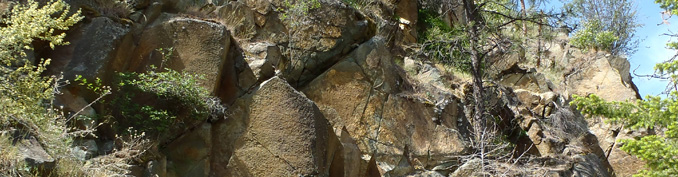
Plains Sill
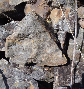
You can tell the difference between igneous rocks and sedimentary rocks in the Perma area because igneous rocks are uniformly made up of crystals whereas sedimentary rocks are layered and composed of much finer particles of clay and silt and occasionally sand. The images at right illustrate the difference; the photos below compares the igneous rock of the Plains Sill (left side) and Belt rocks (right side).

Prichard — Unit F
The Prichard Formation (along with most of the rocks that underlie the Flathead Reservation) are part of what's called the Belt Supergroup. The Prichard Formation, which underlies most of the southwestern part of reservation is very old. The rocks formed about 1.4 billion years ago, when the earth was around 3 billion years old. For perspective, the earliest fossils of land plants appear in rocks that are about 450 million years old. They are a billion years younger than the Belt rocks. Dinosaurs show up in the fossil record 200 million years after land plants first appear, and humans come on the scene some 240 million years after that. To see how these events fit together, make a timeline.
The Prichard as a whole is about 4 miles deep. Unit F is just one section of the Prichard. It is about 3,000 to 3,600 feet thick and is made up of fine-grained, dark-gray-colored siltite and gray argillite (siltite and argillite are hardened siltstone or shale—shale is simply hardened mud). When the rock splits and weathers, the iron it contains oxidizes or rusts, giving the rock a redish, tan color. Unit F also includes pyrite, also known as “fool’s gold”. This unit of the Prichard is layered and splits easily.
Prichard — Unit G
The Prichard Formation (along with most of the rocks of that underlie the Flathead Reservation) are part of what's called the Belt Supergroup. The Prichard Formation, which underlies most of the southwestern part of reservation is very old. The rocks formed about 1.4 billion years ago, when the earth was around 3 billion years old. For perspective, the earliest fossils of land plants appear in rocks that are about 450 million years old. They are a billion years younger than the Belt rocks. Dinosaurs show up in the fossil record 200 million years after land plants first appear, and humans come on the scene some 240 million years after that. To see how these events fit together, make a timeline.
The Prichard as a whole is about 4 miles deep. Unit G is just one section of the Prichard. It is about 900 to 1500 feet thick and is made up of:
• Fine grained quartzite (which is just hardened sandstone) that contains mica
• Gray-colored siltite and gray argillite. Argillite is a clay-rich rock. It is a hardened siltstone or shale (shale is simply hardened mud).
Unit G of the Prichard argillite is finely layered and splits or breaks apart easily. The layers are so fine, in fact, that they are hard to see unless you inspect it closely. Such smooth layers of clay and silt tell us this unit of the Prichard, Unit G, formed from layers of mud laid down 1.4 billion years ago in still waters, well below the reach of waves.
.


Whisky Gulch Sill
Most of the rocks on the Reservation, including those in the Perma area, are sedimentary rocks, which formed from layers of sediment like silt and clay and sand that accumulated on the bottom of an ancient inland sea. Over hundreds of millions of years, heat and pressure converted those sediments to rock. But there are also areas of igneous rocks—rocks that form from magma when it cools. That’s what the Whiskey Gulch Sill is. Like other sills in the Perma area, it formed when magma rose up from below and forced itself between weak, easily penetrated, layers of rock or sediment. It is thought that the Whiskey Gulch Sill magma intruded when the sediments were partly wet. The Whiskey Gulch Sill, like other Perma sills, is a mafic rock, meaning it is high in magnesium and iron (in fact, the word mafic comes from combining the words magnesium (ma) and ferric (fic) (ferric means iron). When the rock is exposed, the iron oxidizes and gives the rock a reddish color.

You can tell the difference between igneous rocks and sedimentary rocks in the Perma area because igneous rocks are uniformly made up of crystals whereas sedimentary rocks are layered and composed of much finer particles of clay and silt and occasionally sand. The images below illustrate the difference (igneous on the left side, Belt sedimentary on the right).

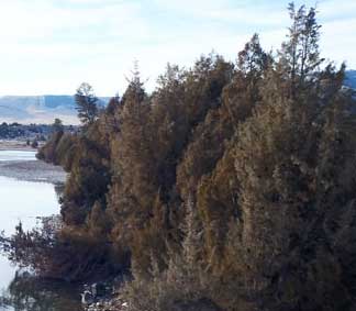
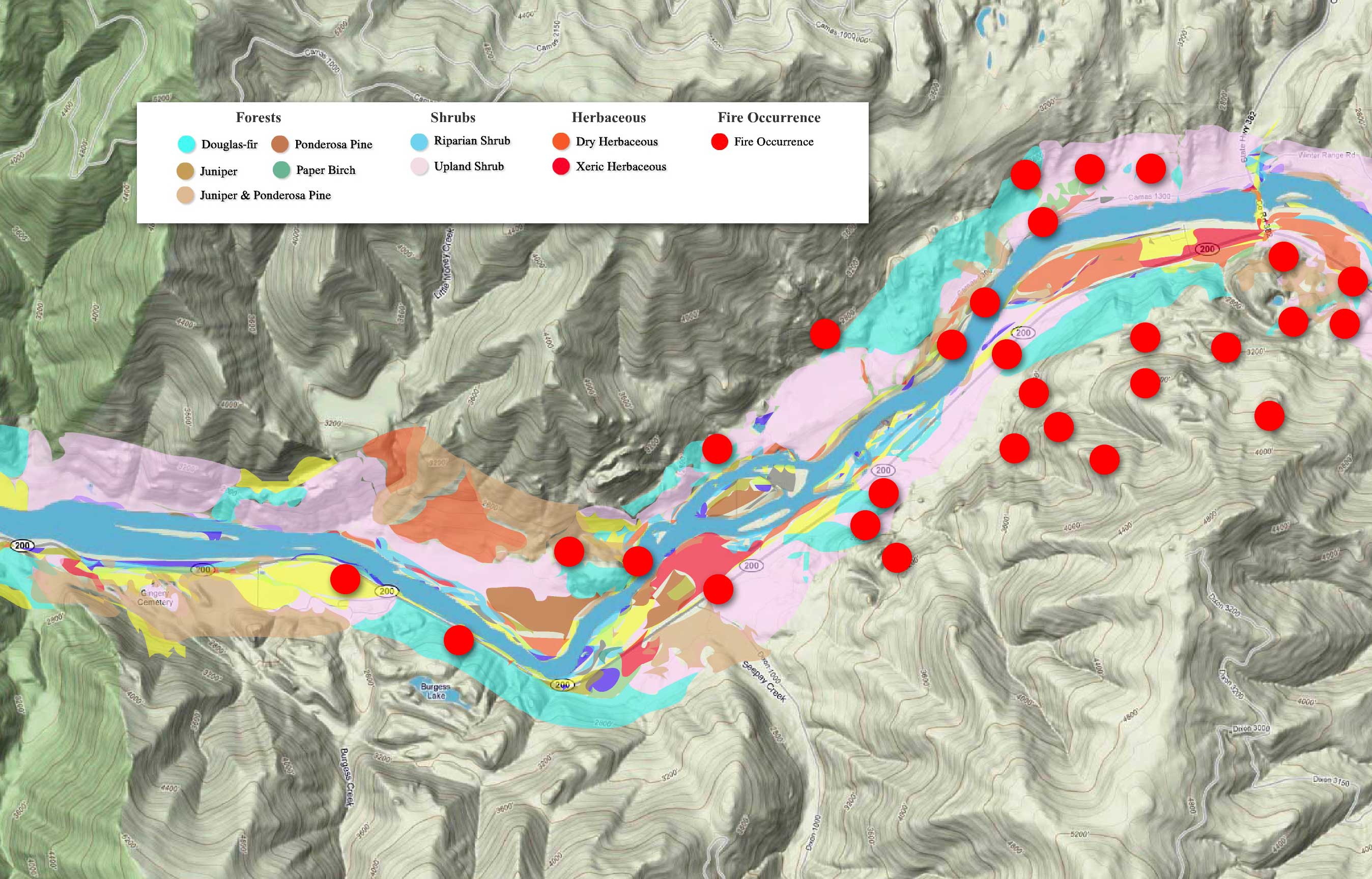
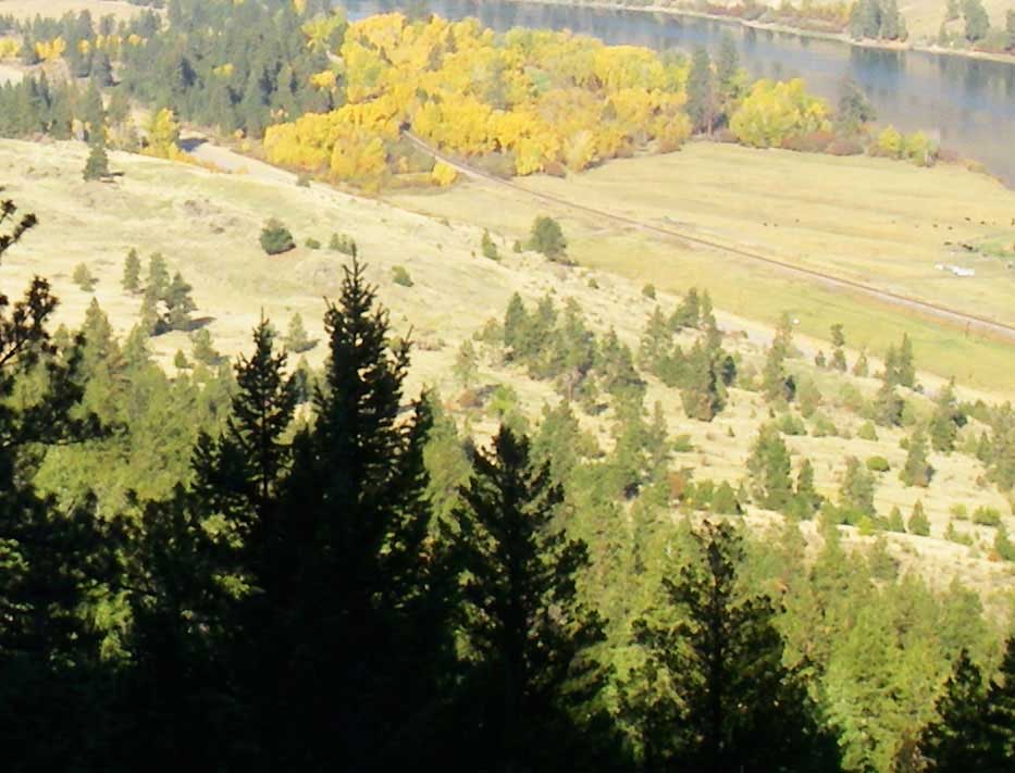
Riparian Vegetation
The term riparian vegetation refers to the plant habitats and communities along the river margins and its banks. Riparian zones are important because so many birds and mammals in western Montana depend on them.
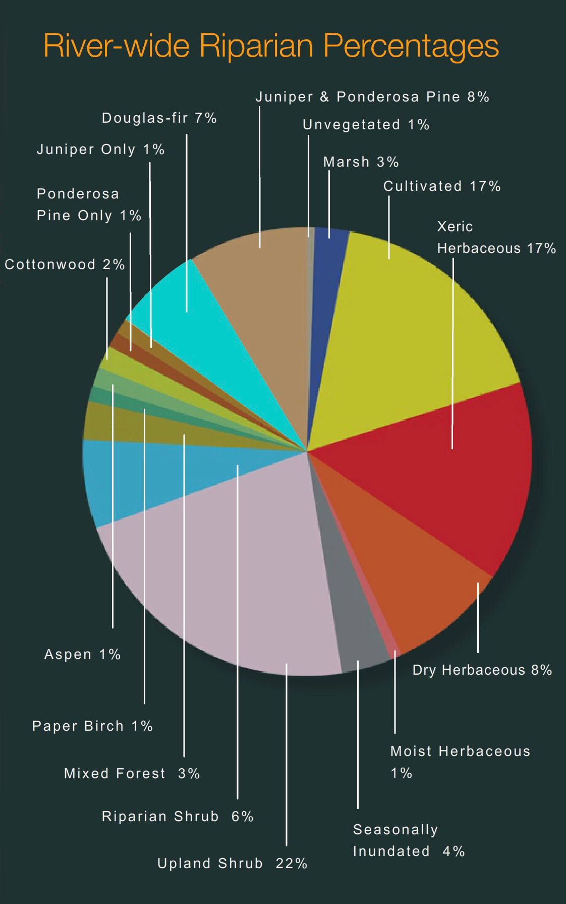
The first tab is a map of riparian vegetation types in Reach Six; the second shows a pie chart that displays the percentage of each of those types for the entire length of the river (all 72 miles).

Vegetation Type Descriptions
Click a type to learn more
- Juniper-only Forests
- Douglas-fir
- Juniper & Ponderosa Pine
- Ponderosa Pine Forests
- Paper Birch
- Riparian Shrub Communities
- Upland Shrub Communities
- Dry Herbaceous Communities
- Xeric Herbaceous Communities
- Black Cottonwood Forests
- Cultivated Land
- Marsh Communities
- Seasonally Inundated Mudflats and Gravel Bars
- Mixed Forest Communities
- Fire Occurence

Juniper-Only Forests
Salish: Punɫp
Kootenai: ʾakuk̓pⱡuⱡaⱡ
These forests, which make up about 1% of the river's riparian zone, often contain ponderosa pine.
Juniper varies from a bushy shrub to a tree 50-feet tall. The trunk is short and stout. The crown is generally dense, although the branches may become long, slender and drooping.
The wood has been used for lance shafts and bows, and the needles burned ceremonially. Tea can be made from the boughs and branches to treat colds.
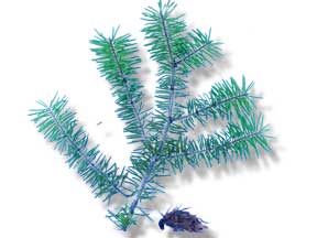
Douglas-fir Forests
Salish: Cq̓ɫp
Kootenai: Ⱡu
Douglas-fir forests make up about 7% of the riparian zone. These forests often contain some ponderosa pine and Rocky Mountain juniper as well.
Douglas-fir is really not a fir at all. Many things about it are different than the true firs, especially the cones. Because of fire exclusion, this tree has greatly expanded its distribution. Shrubs in the understory include snowberry, Wood's rose, service-berry, Oregon-grape, ninebark, and ocean spray. Forbs include dandelion, common yarrow, spotted knapweed, and wild strawberry.

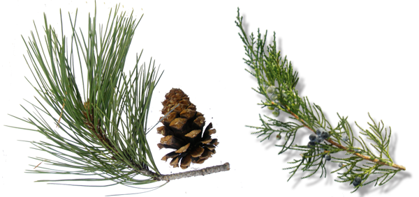
Juniper and Ponderosa Pine Forests
Salish: Punɫp / Sʔátq͏ʷɫp
Kootenai: ʾakukpⱡuⱡaⱡ / Himu
These two trees are found together throughout the river corridor, especially below Goose Bend. This type of vegetation makes up about 8% of the riparian zone.


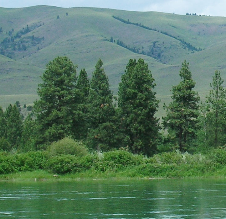
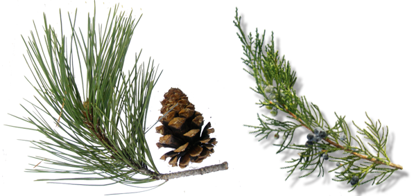
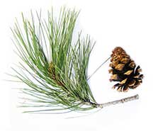
Ponderosa Pine Forests
Salish: Sʔátq͏ʷɫp
Kootenai: Himu
Ponderosa pine, pure stands of which occupy about 1% of the river corridor's riparian zone, is the state tree of Montana. It is a very important tree for lumber, growing from 50 to 180 feet tall. On the river it is found by itself, but it also grows with black cotton-wood and juniper and dense shrubs, including red-osier dogwood, serviceberry, and Wood's rose.
It has three needles or sometimes two in each bundle and they are usually 4-7 inches long in tufts at the end of the branches. The cones are 3-6 inches long, broadly rounded at base, tapered to the tip, short and squat; bright green, becoming reddish brown as they get older and armed with small spines. The bark is dark on small trees, cinnamon-brown to orange-yellow, thick and broken into large, flat, irregular “jig-saw puzzle-shaped” plates on old trees.

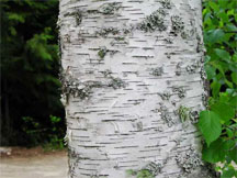
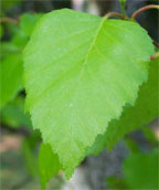
Paper Birch
Paper birch, which occupies about 1% of the river corridor's riparian zone, grows 60 to 80 feet tall and cannot tolerate shade. It takes over areas after fires and was used in the past to make canoes and baskets.
The leaves are oval or ovate, 2-5 inches long and 1-2 inches wide, usually rounded at the base with the margins toothed. They are dark green and shiny above, yellow-green below.
The bark is creamy white, separating into thin, papery layers, and marked by long, narrow, horizontal, dark, corky lines. The inner bark is orange.
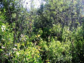
Riparian Shrub Communities
Riparian shrub communities, which occupy about 6% of the riparian zone in the river corridor, are often found near the high water mark along the river.
They most often include sandbar willow, red-osier dogwood, Douglas hawthorn, Wood's rose, western snowberry and Bebb's willow. Willow and dogwood are often found together, and rose is frequently found with hawthorne, dogwood, and snowberry.
Grasses frequently found include redtop bentgrass, reed canarygrass, fowl bluegrass, Kentucky bluegrass, and quackgrass.
Other plants in this community include Canada thistle, hemp dogbane, black medic, Canada goldenrod, loosestrife and poison ivy.
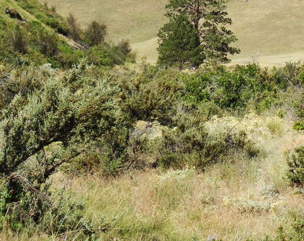
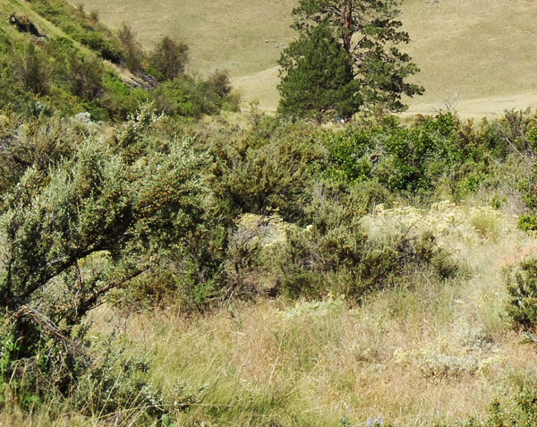
Upland Shrub Communities
Upland shrub communities, which occupy about 22% of the riparian zone in the river corridor, can be found both near the high water mark and a considerable distance inland and above the high water mark.
Shrubs found in upland communities include big sagebrush, rubber rabbitbrush, antelope bitterbrush, oceanspray, and serviceberry.
Bluebunch wheatgrass, cheatgrass, prairie junegrass (Koeleria cristata) and Kentucky bluegrass are the most common grasses, and fringed sagebrush, arrowleaf balsamroot, spotted knapweed, and mullein are the most common forbs.

Dry Herbaceous Communities
Dry herbaceous communities, which occupy about 8% of the river corridor, are often found on steep slopes and rocky banks adjacent to the river. Many of these sites are adjacent to the riparian zone; few are contained within it.
The community includes three types of subcommunities: western wheatgrass with Idaho fescue; bluebunch wheatgrass with rough fescue; and Kentucky bluegrass with quackgrass (this last one is found on disturbed sites). Redtop bentgrass and Canada thistle are found on many of these sites, as is spotted knapweed, common timothy, baltic rush, and prickly lettuce.

Xeric Herbaceous Communities
Xeric means extremely dry, and xeric herbaceous communities are the driest on the river. They are usually found farther from the riparian zone or are on especially fine and dry soils. The dominant species in this community are needle-and-thread grass with red threeawn grass, spotted knapweed, erect cinquefoil, and sand dropseed. Cheatgrass, fringed sagebrush, goatweed, and Kentucky bluegrass are also common.
Many of these species have been introduced, and some are troublesome weeds. Fringed sagebrush is an indicator of intensive cattle grazing, Many of these communities are obviously impacted by grazing and some appear to have been heavily grazed in the 1930's and never allowed to recover. These areas are not significantly impacted by water levels, but are used by geese because of their forage value and proximity to the river.

Black Cottonwood Forest
Salish: Mulš
Kootenai: Kanuⱡ mamaⱡ aqpiʾk
Black cottonwood forests occupy about 2% of the riparian zone of the river corridor. The tree grows up to 120 feet high. It is the largest of our cottonwoods. When mature, its trunk is often free of branches up to one-half its height. It has broad, oval-shaped crowns when grown in open sites. It grows on moist soils along streams and rivers. The leaves are 3-7 inches long and 3-4 inches wide; broad, rounded at base. The bark is smooth and greenish on young stems; becomes gray and sharply furrowed, 1 to 2 inches thick as the tree ages.
Because of the way Kerr Dam was operated for many decades (major reductions in peak flows and rapidly fluctuating water levels), there has generally been a tremendous loss of species like black cottonwood and sandbar willow, which pioneer flooded areas like gravel bars. At the same time species ponderosa pine and Rocky Mountain juniper have expanded.

Cultivated Land
Cultivated land includes pasture lands (lands grazed annually by livestock, alfalfa, grainfields, and lawns. By curtailing peak flows, Kerr Dam has "dewatered" much of the floodplain, and that has led to a tremendous conversion of the riparian vegetation to agricultural land. In addition. many of the wetter shrub types have been changed to herbaceous vegetation because of overgrazing of the riparian zone,

Marsh Communities
Marsh communities on the river can be classified as tall and short. Tall marshes are made up of common cattail, flowering rush, hardstem bulrush, and reed canarygrass. Dominant species in the short marsh include water horsetail, common spikerush, arrowroot, beaked sedge, marestail and a combination of jointed rush and slender spikerush.
Marsh communities are vulnerable to water level fluctuations, yet are critical feeding sites for numerous shorebirds and fish, as well as geese in the late spring.
It is likely that the diversity of marsh habitat was greater on the river before regulation of water levels.
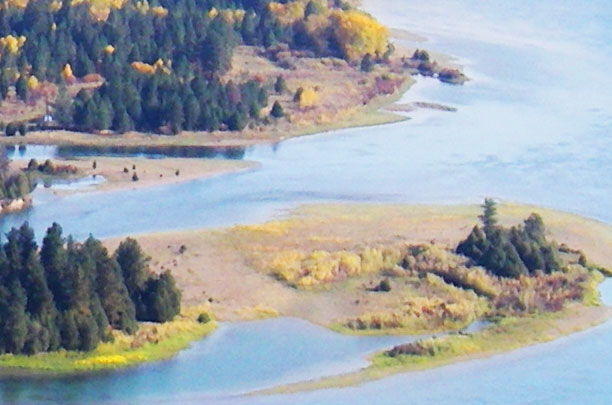
Seasonally Inundated Mudflats and Gravel Bars
Gravel bars and mudflats are found throughout the river corridor. Because of the fluctuating water levels (in spring they are underwater and in fall they are exposed), these areas are, for the most part, unvegetated. Still they provide important habitat for shorebirds and waterfowl.

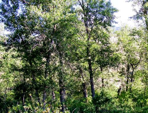
Mixed Forest Communities
Mixed forests are highly variable in the species they have, but birch and Douglas fir are common together, sometimes with black cottonwood, aspen, and/or Rocky Mountain maple as well. Black cottonwood and ponderosa pine are also frequently found together.
Because of the different species present, these forests are used by many wildlife species and have among the highest diversity of bird life.

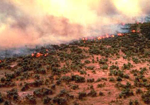
Fire Occurrence
Areas within the Flathead River Corridor burned on average about once every 8.5 years prior to the days of fire suppression (the average was 8.5 years but actual fire frequency ranged between 5 to 25 years). Some of those fires were lit by Indian people to clear campsites and improve forage for horses and wildlife. The fires generally did not kill large, mature trees. They were brief, low intensity fires that burned mostly grass and shrubs.
It is difficult to control wildfires within the river corridor because the roads are poor and parts of the corridor don't have any roads. Fuels include grasses and native shrubs (sage and bitterbrush), and open stands of ponderosa pine and juniper. There are lots of important natural and cultural resources along the river, many of which benefit from frequent fires. Prescribed fire is the best way to assure protection and restoration of those resources.
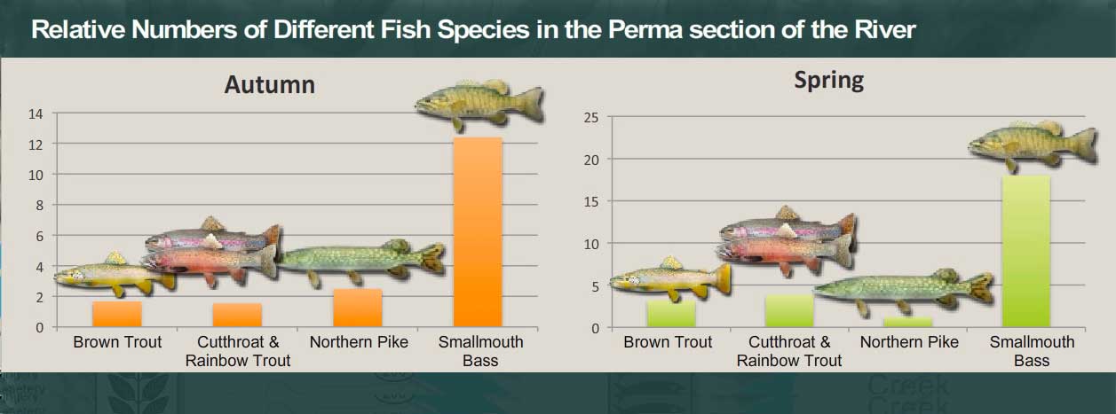

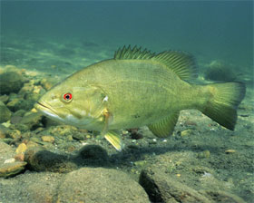
Discussion: Establishing a New Population
Smallmouth bass were introduced into waters of the Flathead Indian Reservation in the mid-1980s. The species was initially stocked into Crow Reservoir, an irrigation storage reservoir in the Crow Creek drainage that has a direct tributary outlet to the Flathead River. Smallmouth bass quickly moved to the Flathead River and rapidly colonized the river downstream of Flathead Lake.
They have done well. They grow fast and are in relatively good condition for the most part. The river is relatively warm, and smallmouth bass like warm water. In addition to the temperature of the water, smallmouth bass may be better competitors than other fishes in the river, or they may be exploiting different resources than other fishes that has allowed them to maintain comparatively high condition factors and growth rates. It appears they are here to stay.
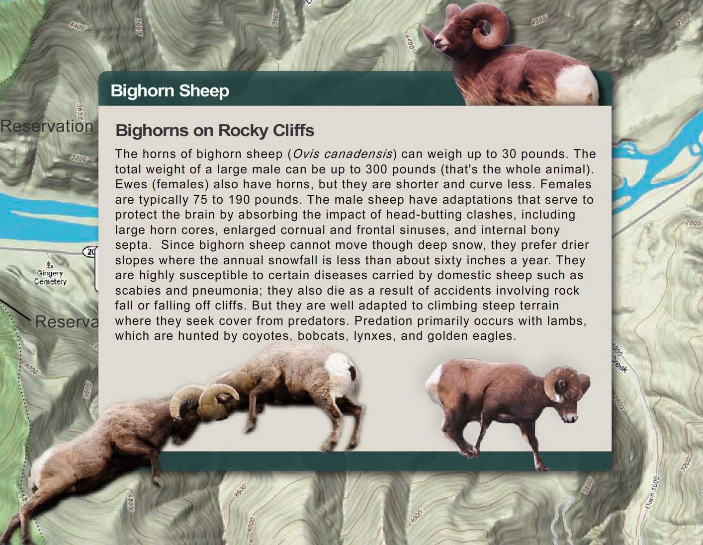
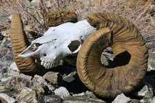
Adult Rocky Mountain bighorn sheep rams have massive horns that can weigh over 30 pounds. During the fall rut, or mating season, rams bang horns to establish dominance and breeding rights. Rearing up on their hind legs, opposing rams charge full speed toward each other and butt heads using their horns as battering rams. The sound can be heard a mile away.
Although they may hit with considerable force, the animals are seldom hurt because the skull and massive neck muscles absorb the force of the blow. There are other adaptations too. Male bighorn sheep have large horn cores, enlarged cornual and frontal sinuses and internal bony septa (septa are fin-shaped projections of bone in the sinus). These adaptations protect the sheep's brain by absorbing the impact of clashes.

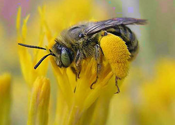
Bees depend on nectar-producing flowers, and in arid places like the river corridor, low amounts of rainfall can mean that the amount of nectar produced by flowers can be unpredictable. So plants like rabbitbrush, with predictable blooms with reliable nectar flows, are important for our native bees, which in turn are vital for pollination of our wildflowers and other plants. Indeed, the late summer-fall bloom of rabbitbrush supports a lot of bees. We don't have data for the river corridor, but in one area in the southwest, 278 bee species used rabbitbrush plant communities—over 60% of fall flying bees. Bee visitation to rabbitbrush far exceeded their visits to any other flowering plant. Other nectar drinkers like butterflies and moths were also found in high numbers on rabbitbrush. Factors that appear to contribute to the attraction include predictable bloom even in years of drought, abundant flowers, and extended bloom.
If you want to see just how attractive rabbitbrush is to insects, just visit the river corridor in the fall and find a rabbitbrush plant. Count how many different insects you see.
On this page you can explore River Reach Six, which runs from a point 9.3 miles downstream of Dixon to the Reservation Boundary. The river drops about 1.3 feet/mile. The river channel is braided, and there are major island complexes, gravel bars, and extensive backwater areas. The Perma Bridge crosses the river at Perma.
Reach Six
From a point 9.3 miles downstream of Dixon to the Reservation Boundary

Click a Map Pin
Fence Lizard

If you were to turn a fence lizard over and look at its belly, you would see two bright blue or turquoise patches on either size (one common name for the lizard is "blue-bellied lizard"). Like the canyon wren's song, these patches are used by males to warn off other males and to attract females (the male's patches become much brighter during breeding season).
Why do you think a bright blue belly on one male would scare away other males?
The map above shows the distribution of this lizard in the U.S. How do you account for one tiny population (circled in red) isolated so far from the rest of the population? How could such a population get started?
If you were to turn a fence lizard over and look at its belly, you would see two bright blue or turquoise patches on either size (one common name for the lizard is "blue-bellied lizard"). Like the canyon wren's song, these patches are used by males to warn off other males and to attract females (the male's patches become much brighter during breeding season).
Why do you think a bright blue belly on one male would scare away other males?
Perma Geology: Belt Supergroup Rocks and Igneous Sills

At Perma, igneous rocks (rocks that form from magma when it cools) intruded into the Belt rocks. These intrusions are known as sills, and Perma is the only place on the Reservation where they occur.
Click on the map markers below to learn more about geology in the Perma area.

Prichard — Unit D

The Prichard Formation (along with most of the rocks of that underlie the Flathead Reservation) are part of what's called the Belt Supergroup. The Prichard Formation, which underlies most of the southwestern part of reservation is very old. The rocks formed about 1.4 billion years ago, when the earth was around 3 billion years old. For perspective, the earliest fossils of land plants appear in rocks that are about 450 million years old. They are a billion years younger than the Belt rocks. Dinosaurs show up in the fossil record 200 million years after land plants first appear, and humans come on the scene some 240 million years after that. To see how these events fit together, make a timeline.
The Prichard as a whole is about 4 miles deep. Unit D is just one section of the Prichard. It is about 1,500 to 2,400 feet thick and is made up of gray, rust-colored weathering, silty argillite containing abundant chlorite crystals (formed when iron combines with silica compounds) and sparse garnet (garnet are silicate minerals that are used as gemstones and abrasives).
Paradise Sill
Most of the rocks on the Reservation, including those in the Perma area, are sedimentary rocks, which formed from layers of sediment like silt and clay and sand that accumulated on the bottom of an ancient inland sea. Over hundreds of millions of years, heat and pressure converted those sediments to rock. But there are also areas of igneous rocks—rocks that form from magma when it cools. That’s what the Paradise Sill is. Like other sills in the Perma area, it formed when magma rose up from below and forced itself between weak, easily penetrated, layers of rock or sediment. It is thought that the Paradise Sill magma intruded when the sediments were partly wet. The Paradise Sill, like other Perma sills, is a mafic rock, meaning it is high in magnesium and iron (in fact, the word mafic comes from combining the words magnesium (ma) and ferric (fic) (ferric means iron). When the rock is exposed, the iron oxidizes and gives the rock a reddish color.
You can tell the difference between igneous rocks and sedimentary rocks in the Perma area because igneous rocks are uniformly made up of crystals (see photo top right) whereas sedimentary rocks are layered and composed of much finer particles of clay and silt and occasionally sand. The images (lower right) illustrate the difference.

Prichard — Unit B

The Prichard Formation (along with most of the rocks that underlie the Flathead Reservation) are part of what's called the Belt Supergroup. The Prichard Formation, which underlies most of the southwestern part of the reservation is very old.
The rocks formed about 1.4 billion years ago, when the earth was around 3 billion years old. For perspective, the earliest fossils of land plants appear in rocks that are about 450 million years old. They are a billion years younger than the Belt rocks. Dinosaurs show up in the fossil record 200 million years after land plants first appear, and humans come on the scene some 240 million years after that. To see how these events fit together, make a timeline. The Prichard as a whole is about 4 miles deep.
Unit B is just one section of the Prichard. It is about 1,500 to 3,000 feet thick and is made up of dark-gray siltite and light-gray argillite but it rusts when exposed to the weather so it has a rusty-redish color. (Argillite is a clay-rich rock. It is a hardened siltstone or shale (shale is simply hardened mud)).
.
Surficial (Surface) Deposits

What geologists call surfical deposits refers to what lies on the surface, above the bedrock. In the Perma area, these deposits are mostly found in the valley bottom and are cut by the river. They are alluvium and lake deposits. Alluvim (top right) is gravel, sand, and minor amounts of silt that have been deposited over the past few thousand years by the river (see the top photo at right). The thickness of these deposits, ranges from a few inches to about 40 feet.
The other kind of surficial deposit, the lake or lacustrine deposits, are the thick layers of silts and clays that settled out of Glacial Lake Missoula during the last ice age (lower right and bottom photo). That ice age (known as the Pleistocene Ice Age) started about 2 million years ago and ended about 10,000 years ago. The sediments are tan colored and made up of many thin layers of silt and clay. They can be from 1 foot to more than 300 feet thick. In places farther upstream, such as near Sloans Bridge, it forms high cliffs. Near Perma, the deposits, cut by streams or roads might be 10 to 20 feet high. Cavity nesting birds often excavate holes in these banks. Where the deposits are lower, coyotes, foxes, and badgers and other mammals find good places for dens because the deposits make for easy digging, and the dens are relatively stable.


Empire Formation

The Empire Formation is gray to green and weathers to light green. The rock in the Empire is mostly argillite. Near Perma, the Empire Formation has grayish to very light green color. But elsewhere, like in Glacier National Park, it is more greenish. The greenness comes from a chemical process called reduction, the exact opposite of what occurs when iron rusts. The sediments—silt and clay—that would become the Empire Formation, settled out in the bottom of a large inland sea. They contained iron oxide, but because they were underwater and not exposed to oxygen, the iron did not rust or oxidize. Instead, it combined with silica compounds. Then heat and pressure converted the iron-silicate minerals to chlorite, the green compound that colored the rock.
Like the Prichard, the Empire Formation is old, between 1 billion and 700 million years old.

Plains Sill


You can tell the difference between igneous rocks and sedimentary rocks in the Perma area because igneous rocks are uniformly made up of crystals whereas sedimentary rocks are layered and composed of much finer particles of clay and silt and occasionally sand. The images at right illustrate the difference; the photos below compares the igneous rock of the Plains Sill (left side) and Belt rocks (right side).
Prichard — Unit F

The Prichard Formation (along with most of the rocks that underlie the Flathead Reservation) are part of what's called the Belt Supergroup. The Prichard Formation, which underlies most of the southwestern part of reservation is very old. The rocks formed about 1.4 billion years ago, when the earth was around 3 billion years old. For perspective, the earliest fossils of land plants appear in rocks that are about 450 million years old. They are a billion years younger than the Belt rocks. Dinosaurs show up in the fossil record 200 million years after land plants first appear, and humans come on the scene some 240 million years after that. To see how these events fit together, make a timeline.
The Prichard as a whole is about 4 miles deep. Unit F is just one section of the Prichard. It is about 3,000 to 3,600 feet thick and is made up of fine-grained, dark-gray-colored siltite and gray argillite (siltite and argillite are hardened siltstone or shale—shale is simply hardened mud). When the rock splits and weathers, the iron it contains oxidizes or rusts, giving the rock a redish, tan color. Unit F also includes pyrite, also known as “fool’s gold”. This unit of the Prichard is layered and splits easily.

Prichard — Unit G

The Prichard Formation (along with most of the rocks of that underlie the Flathead Reservation) are part of what's called the Belt Supergroup. The Prichard Formation, which underlies most of the southwestern part of reservation is very old. The rocks formed about 1.4 billion years ago, when the earth was around 3 billion years old. For perspective, the earliest fossils of land plants appear in rocks that are about 450 million years old. They are a billion years younger than the Belt rocks. Dinosaurs show up in the fossil record 200 million years after land plants first appear, and humans come on the scene some 240 million years after that. To see how these events fit together, make a timeline.
The Prichard as a whole is about 4 miles deep. Unit G is just one section of the Prichard. It is about 900 to 1500 feet thick and is made up of:
• Fine grained quartzite (which is just hardened sandstone) that contains mica
• Gray-colored siltite and gray argillite. Argillite is a clay-rich rock. It is a hardened siltstone or shale (shale is simply hardened mud).
Unit G of the Prichard argillite is finely layered and splits or breaks apart easily. The layers are so fine, in fact, that they are hard to see unless you inspect it closely. Such smooth layers of clay and silt tell us this unit of the Prichard, Unit G, formed from layers of mud laid down 1.4 billion years ago in still waters, well below the reach of waves.
.


Whisky Gulch Sill

Most of the rocks on the Reservation, including those in the Perma area, are sedimentary rocks, which formed from layers of sediment like silt and clay and sand that accumulated on the bottom of an ancient inland sea. Over hundreds of millions of years, heat and pressure converted those sediments to rock. But there are also areas of igneous rocks—rocks that form from magma when it cools. That’s what the Whiskey Gulch Sill is. Like other sills in the Perma area, it formed when magma rose up from below and forced itself between weak, easily penetrated, layers of rock or sediment. It is thought that the Whiskey Gulch Sill magma intruded when the sediments were partly wet. The Whiskey Gulch Sill, like other Perma sills, is a mafic rock, meaning it is high in magnesium and iron (in fact, the word mafic comes from combining the words magnesium (ma) and ferric (fic) (ferric means iron). When the rock is exposed, the iron oxidizes and gives the rock a reddish color.
You can tell the difference between igneous rocks and sedimentary rocks in the Perma area because igneous rocks are uniformly made up of crystals whereas sedimentary rocks are layered and composed of much finer particles of clay and silt and occasionally sand. The images below illustrate the difference (igneous on the left side, Belt sedimentary on the right).

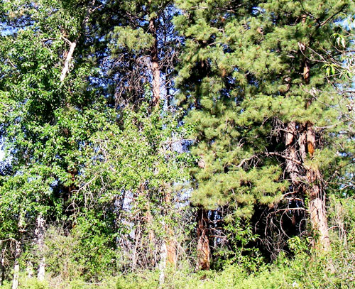
Riparian Vegetation
The term riparian vegetation refers to the plant habitats and communities along the river margins and its banks. Riparian zones are important because so many birds and mammals in western Montana depend on them.
The first tab is a map of riparian vegetation types in Reach Six; the second shows a pie chart that displays the percentage of each of those types for the entire length of the river (all 72 miles).

Vegetation Type Descriptions
Click a type to learn more
- Juniper-only Forests
- Douglas-fir
- Juniper & Ponderosa Pine
- Ponderosa Pine Forests
- Paper Birch
- Riparian Shrub Communities
- Upland Shrub Communities
- Dry Herbaceous Communities
- Xeric Herbaceous Communities
- Black Cottonwood Forests
- Cultivated Land
- Marsh Communities
- Seasonally Inundated Mudflats and Gravel Bars
- Mixed Forest Communities
- Fire Occurence
Juniper-Only Forests
Salish: Punɫp
Kootenai: ʾakuk̓pⱡuⱡaⱡ
These forests, which make up about 1% of the river's riparian zone, often contain ponderosa pine.
Juniper varies from a bushy shrub to a tree 50-feet tall. The trunk is short and stout. The crown is generally dense, although the branches may become long, slender and drooping.
The wood has been used for lance shafts and bows, and the needles burned ceremonially. Tea can be made from the boughs and branches to treat colds.

Douglas-fir Forests
Salish: Cq̓ɫp
Kootenai: Ⱡu
Douglas-fir forests make up about 7% of the riparian zone. These forests often contain some ponderosa pine and Rocky Mountain juniper as well.
Douglas-fir is really not a fir at all. Many things about it are different than the true firs, especially the cones. Because of fire exclusion, this tree has greatly expanded its distribution. Shrubs in the understory include snowberry, Wood's rose, service-berry, Oregon-grape, ninebark, and ocean spray. Forbs include dandelion, common yarrow, spotted knapweed, and wild strawberry.

Juniper and Ponderosa Pine Forests
Salish: Punɫp / Sʔátq͏ʷɫp
Kootenai: ʾakukpⱡuⱡaⱡ / Himu
These two trees are found together throughout the river corridor, especially below Goose Bend. This type of vegetation makes up about 8% of the riparian zone.

Ponderosa Pine Forests
Salish: Sʔátq͏ʷɫp
Kootenai: Himu
Ponderosa pine, pure stands of which occupy about 1% of the river corridor's riparian zone, is the state tree of Montana. It is a very important tree for lumber, growing from 50 to 180 feet tall. On the river it is found by itself, but it also grows with black cotton-wood and juniper and dense shrubs, including red-osier dogwood, serviceberry, and Wood's rose.
It has three needles or sometimes two in each bundle and they are usually 4-7 inches long in tufts at the end of the branches. The cones are 3-6 inches long, broadly rounded at base, tapered to the tip, short and squat; bright green, becoming reddish brown as they get older and armed with small spines. The bark is dark on small trees, cinnamon-brown to orange-yellow, thick and broken into large, flat, irregular “jig-saw puzzle-shaped” plates on old trees.

Paper Birch
Paper birch, which occupies about 1% of the river corridor's riparian zone, grows 60 to 80 feet tall and cannot tolerate shade. It takes over areas after fires and was used in the past to make canoes and baskets.
The leaves are oval or ovate, 2-5 inches long and 1-2 inches wide, usually rounded at the base with the margins toothed. They are dark green and shiny above, yellow-green below.
The bark is creamy white, separating into thin, papery layers, and marked by long, narrow, horizontal, dark, corky lines. The inner bark is orange.

Riparian Shrub Communities
Riparian shrub communities, which occupy about 6% of the riparian zone in the river corridor, are often found near the high water mark along the river.
They most often include sandbar willow, red-osier dogwood, Douglas hawthorn, Wood's rose, western snowberry and Bebb's willow. Willow and dogwood are often found together, and rose is frequently found with hawthorne, dogwood, and snowberry.
Grasses frequently found include redtop bentgrass, reed canarygrass, fowl bluegrass, Kentucky bluegrass, and quackgrass.
Other plants in this community include Canada thistle, hemp dogbane, black medic, Canada goldenrod, loosestrife and poison ivy.

Upland Shrub Communities
Upland shrub communities, which occupy about 22% of the riparian zone in the river corridor, can be found both near the high water mark and a considerable distance inland and above the high water mark.
Shrubs found in upland communities include big sagebrush, rubber rabbitbrush, antelope bitterbrush, oceanspray, and serviceberry.
Bluebunch wheatgrass, cheatgrass, prairie junegrass (Koeleria cristata) and Kentucky bluegrass are the most common grasses, and fringed sagebrush, arrowleaf balsamroot, spotted knapweed, and mullein are the most common forbs.
Dry Herbaceous Communities
Dry herbaceous communities, which occupy about 8% of the river corridor, are often found on steep slopes and rocky banks adjacent to the river. Many of these sites are adjacent to the riparian zone; few are contained within it.
The community includes three types of subcommunities: western wheatgrass with Idaho fescue; bluebunch wheatgrass with rough fescue; and Kentucky bluegrass with quackgrass (this last one is found on disturbed sites). Redtop bentgrass and Canada thistle are found on many of these sites, as is spotted knapweed, common timothy, baltic rush, and prickly lettuce.

Xeric Herbaceous Communities
Xeric means extremely dry, and xeric herbaceous communities are the driest on the river. They are usually found farther from the riparian zone or are on especially fine and dry soils. The dominant species in this community are needle-and-thread grass with red threeawn grass, spotted knapweed, erect cinquefoil, and sand dropseed. Cheatgrass, fringed sagebrush, goatweed, and Kentucky bluegrass are also common.
Many of these species have been introduced, and some are troublesome weeds. Fringed sagebrush is an indicator of intensive cattle grazing, Many of these communities are obviously impacted by grazing and some appear to have been heavily grazed in the 1930's and never allowed to recover. These areas are not significantly impacted by water levels, but are used by geese because of their forage value and proximity to the river.

Black Cottonwood Forest
Salish: Mulš
Kootenai: Kanuⱡ mamaⱡ aqpiʾk
Black cottonwood forests occupy about 2% of the riparian zone of the river corridor. The tree grows up to 120 feet high. It is the largest of our cottonwoods. When mature, its trunk is often free of branches up to one-half its height. It has broad, oval-shaped crowns when grown in open sites. It grows on moist soils along streams and rivers. The leaves are 3-7 inches long and 3-4 inches wide; broad, rounded at base. The bark is smooth and greenish on young stems; becomes gray and sharply furrowed, 1 to 2 inches thick as the tree ages.
Because of the way Kerr Dam was operated for many decades (major reductions in peak flows and rapidly fluctuating water levels), there has generally been a tremendous loss of species like black cottonwood and sandbar willow, which pioneer flooded areas like gravel bars. At the same time species ponderosa pine and Rocky Mountain juniper have expanded.
Cultivated Land
Cultivated land includes pasture lands (lands grazed annually by livestock, alfalfa, grainfields, and lawns. By curtailing peak flows, Kerr Dam has "dewatered" much of the floodplain, and that has led to a tremendous conversion of the riparian vegetation to agricultural land. In addition. many of the wetter shrub types have been changed to herbaceous vegetation because of overgrazing of the riparian zone,

Marsh Communities
Marsh communities on the river can be classified as tall and short. Tall marshes are made up of common cattail, flowering rush, hardstem bulrush, and reed canarygrass. Dominant species in the short marsh include water horsetail, common spikerush, arrowroot, beaked sedge, marestail and a combination of jointed rush and slender spikerush.
Marsh communities are vulnerable to water level fluctuations, yet are critical feeding sites for numerous shorebirds and fish, as well as geese in the late spring.
It is likely that the diversity of marsh habitat was greater on the river before regulation of water levels.

Seasonally Inundated Mudflats and Gravel Bars
Gravel bars and mudflats are found throughout the river corridor. Because of the fluctuating water levels (in spring they are underwater and in fall they are exposed), these areas are, for the most part, unvegetated. Still they provide important habitat for shorebirds and waterfowl.
Mixed Forest Communities
Mixed forests are highly variable in the species they have, but birch and Douglas fir are common together, sometimes with black cottonwood, aspen, and/or Rocky Mountain maple as well. Black cottonwood and ponderosa pine are also frequently found together.
Because of the different species present, these forests are used by many wildlife species and have among the highest diversity of bird life.
Fire Occurrence
Areas within the Flathead River Corridor burned on average about once every 8.5 years prior to the days of fire suppression (the average was 8.5 years but actual fire frequency ranged between 5 to 25 years). Some of those fires were lit by Indian people to clear campsites and improve forage for horses and wildlife. The fires generally did not kill large, mature trees. They were brief, low intensity fires that burned mostly grass and shrubs.
It is difficult to control wildfires within the river corridor because the roads are poor and parts of the corridor don't have any roads. Fuels include grasses and native shrubs (sage and bitterbrush), and open stands of ponderosa pine and juniper. There are lots of important natural and cultural resources along the river, many of which benefit from frequent fires. Prescribed fire is the best way to assure protection and restoration of those resources.


Discussion: Establishing a New Population
Smallmouth bass were introduced into waters of the Flathead Indian Reservation in the mid-1980s. The species was initially stocked into Crow Reservoir, an irrigation storage reservoir in the Crow Creek drainage that has a direct tributary outlet to the Flathead River. Smallmouth bass quickly moved to the Flathead River and rapidly colonized the river downstream of Flathead Lake.
They have done well. They grow fast and are in relatively good condition for the most part. The river is relatively warm, and smallmouth bass like warm water. In addition to the temperature of the water, smallmouth bass may be better competitors than other fishes in the river, or they may be exploiting different resources than other fishes that has allowed them to maintain comparatively high condition factors and growth rates. It appears they are here to stay.


Adult Rocky Mountain bighorn sheep rams have massive horns that can weigh over 30 pounds. During the fall rut, or mating season, rams bang horns to establish dominance and breeding rights. Rearing up on their hind legs, opposing rams charge full speed toward each other and butt heads using their horns as battering rams. The sound can be heard a mile away.
Although they may hit with considerable force, the animals are seldom hurt because the skull and massive neck muscles absorb the force of the blow. There are other adaptations too. Male bighorn sheep have large horn cores, enlarged cornual and frontal sinuses and internal bony septa (septa are fin-shaped projections of bone in the sinus). These adaptations protect the sheep's brain by absorbing the impact of clashes.
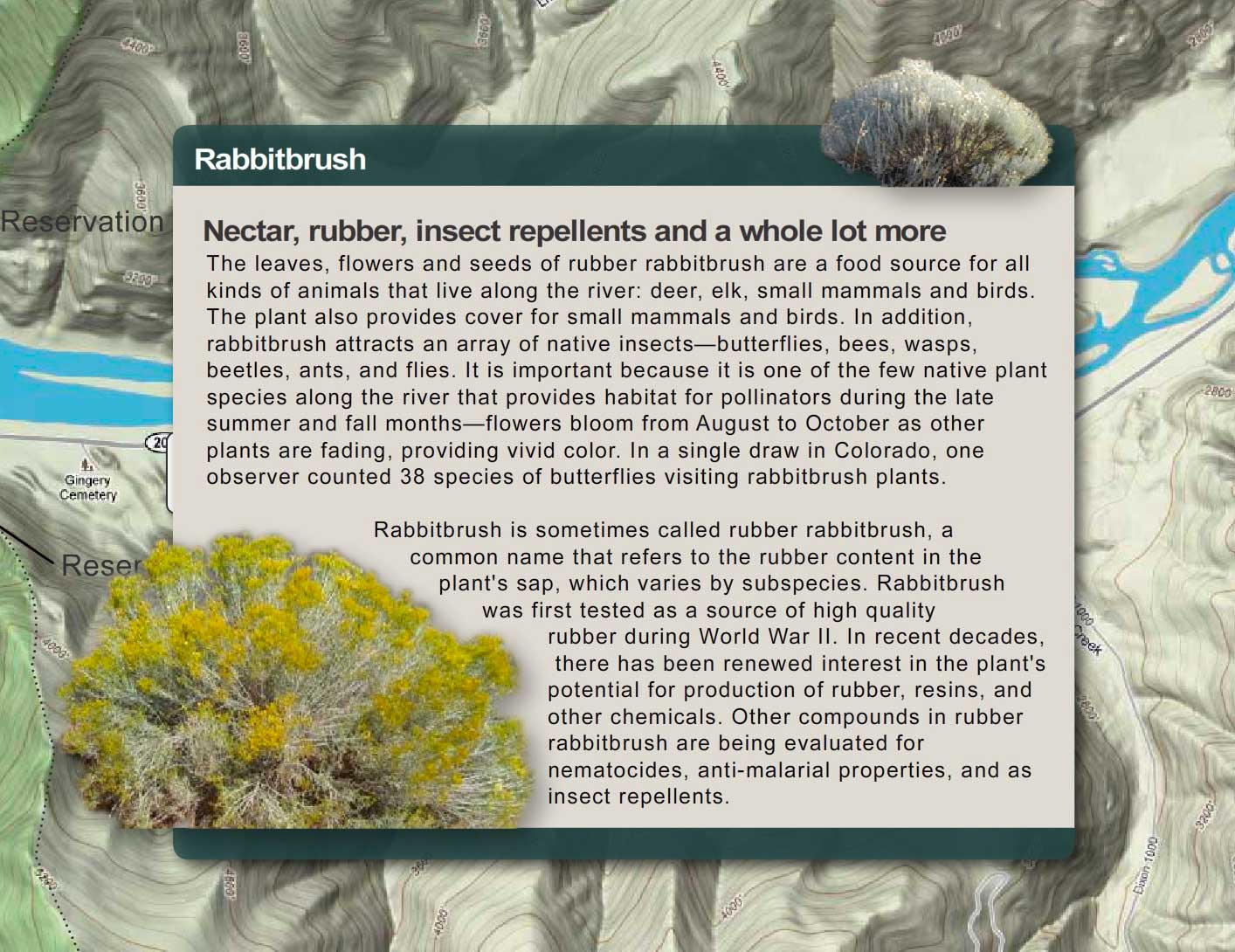

Bees depend on nectar-producing flowers, and in arid places like the river corridor, low amounts of rainfall can mean that the amount of nectar produced by flowers can be unpredictable. So plants like rabbitbrush, with predictable blooms with reliable nectar flows, are important for our native bees, which in turn are vital for pollination of our wildflowers and other plants. Indeed, the late summer-fall bloom of rabbitbrush supports a lot of bees. We don't have data for the river corridor, but in one area in the southwest, 278 bee species used rabbitbrush plant communities—over 60% of fall flying bees. Bee visitation to rabbitbrush far exceeded their visits to any other flowering plant. Other nectar drinkers like butterflies and moths were also found in high numbers on rabbitbrush. Factors that appear to contribute to the attraction include predictable bloom even in years of drought, abundant flowers, and extended bloom.
If you want to see just how attractive rabbitbrush is to insects, just visit the river corridor in the fall and find a rabbitbrush plant. Count how many different insects you see.
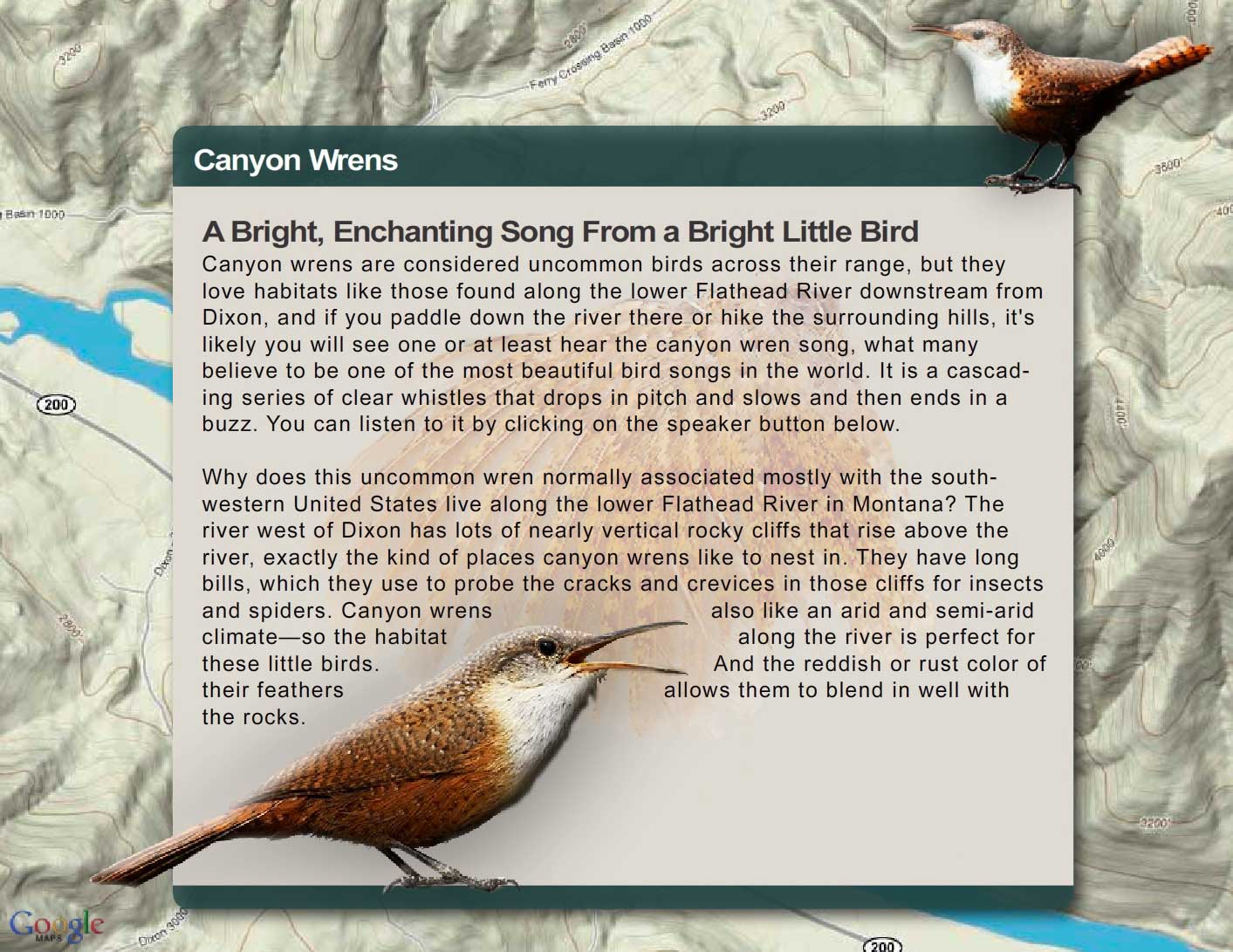
Canyon Wren
Discussion Questions
The difference between what biologists call a bird song and a bird call is somewhat arbitrary, but songs are generally longer, more complex, and learned. Click the listen button at the top to hear the canyon wren song and the one below to hear the call. Calls are generally innate (inborn or instinctual) rather than learned. An alarm call for example is intended to alert all within earshot (even birds of other species) that danger is near.
Canyon Wren Call
Songs on the other hand, tend to be more well developed and are used by birds to defend a feeding or breeding territory or to attract a mate. We know that many song birds learn their songs because within the same species you can hear dialects in different areas or regions, and by playing a recording of a song from one region in a different region, young birds in that second region will pick up the dialect of the first.
Reach Six
On this page you can explore River Reach Six, which runs from a point 9.3 miles downstream of Dixon to the Reservation Boundary. The river drops about 1.3 feet/mile. The river channel is braided, and there are major island complexes, gravel bars, and extensive backwater areas. The Perma Bridge crosses the river at Perma.
Reach Six
From a point 9.3 miles downstream of Dixon to the Reservation Boundary
Click a Map Pin
Fence Lizard

If you were to turn a fence lizard over and look at its belly, you would see two bright blue or turquoise patches on either size (one common name for the lizard is "blue-bellied lizard"). Like the canyon wren's song, these patches are used by males to warn off other males and to attract females (the male's patches become much brighter during breeding season).
Why do you think a bright blue belly on one male would scare away other males?
The map above shows the distribution of this lizard in the U.S. How do you account for one tiny population (circled in red) isolated so far from the rest of the population? How could such a population get started?
If you were to turn a fence lizard over and look at its belly, you would see two bright blue or turquoise patches on either size (one common name for the lizard is "blue-bellied lizard"). Like the canyon wren's song, these patches are used by males to warn off other males and to attract females (the male's patches become much brighter during breeding season).
Why do you think a bright blue belly on one male would scare away other males?
Perma Geology: Belt Supergroup Rocks and Igneous Sills
At Perma, igneous rocks (rocks that form from magma when it cools) intruded into the Belt rocks. These intrusions are known as sills, and Perma is the only place on the Reservation where they occur.
Click on the map markers below to learn more about geology in the Perma area.
Prichard — Unit D

The Prichard Formation (along with most of the rocks of that underlie the Flathead Reservation) are part of what's called the Belt Supergroup. The Prichard Formation, which underlies most of the southwestern part of reservation is very old. The rocks formed about 1.4 billion years ago, when the earth was around 3 billion years old. For perspective, the earliest fossils of land plants appear in rocks that are about 450 million years old. They are a billion years younger than the Belt rocks. Dinosaurs show up in the fossil record 200 million years after land plants first appear, and humans come on the scene some 240 million years after that. To see how these events fit together, make a timeline.
The Prichard as a whole is about 4 miles deep. Unit D is just one section of the Prichard. It is about 1,500 to 2,400 feet thick and is made up of gray, rust-colored weathering, silty argillite containing abundant chlorite crystals (formed when iron combines with silica compounds) and sparse garnet (garnet are silicate minerals that are used as gemstones and abrasives).

Paradise Sill

Most of the rocks on the Reservation, including those in the Perma area, are sedimentary rocks, which formed from layers of sediment like silt and clay and sand that accumulated on the bottom of an ancient inland sea. Over hundreds of millions of years, heat and pressure converted those sediments to rock. But there are also areas of igneous rocks—rocks that form from magma when it cools. That’s what the Paradise Sill is. Like other sills in the Perma area, it formed when magma rose up from below and forced itself between weak, easily penetrated, layers of rock or sediment. It is thought that the Paradise Sill magma intruded when the sediments were partly wet. The Paradise Sill, like other Perma sills, is a mafic rock, meaning it is high in magnesium and iron (in fact, the word mafic comes from combining the words magnesium (ma) and ferric (fic) (ferric means iron). When the rock is exposed, the iron oxidizes and gives the rock a reddish color.
You can tell the difference between igneous rocks and sedimentary rocks in the Perma area because igneous rocks are uniformly made up of crystals (see photo top right) whereas sedimentary rocks are layered and composed of much finer particles of clay and silt and occasionally sand. The images (lower right) illustrate the difference.


Prichard — Unit B

The Prichard Formation (along with most of the rocks that underlie the Flathead Reservation) are part of what's called the Belt Supergroup. The Prichard Formation, which underlies most of the southwestern part of the reservation is very old.
The rocks formed about 1.4 billion years ago, when the earth was around 3 billion years old. For perspective, the earliest fossils of land plants appear in rocks that are about 450 million years old. They are a billion years younger than the Belt rocks. Dinosaurs show up in the fossil record 200 million years after land plants first appear, and humans come on the scene some 240 million years after that. To see how these events fit together, make a timeline. The Prichard as a whole is about 4 miles deep.
Unit B is just one section of the Prichard. It is about 1,500 to 3,000 feet thick and is made up of dark-gray siltite and light-gray argillite but it rusts when exposed to the weather so it has a rusty-redish color. (Argillite is a clay-rich rock. It is a hardened siltstone or shale (shale is simply hardened mud)).
.

Surficial (Surface) Deposits
What geologists call surfical deposits refers to what lies on the surface, above the bedrock. In the Perma area, these deposits are mostly found in the valley bottom and are cut by the river. They are alluvium and lake deposits. Alluvim (top right) is gravel, sand, and minor amounts of silt that have been deposited over the past few thousand years by the river (see the top photo at right). The thickness of these deposits, ranges from a few inches to about 40 feet.
The other kind of surficial deposit, the lake or lacustrine deposits, are the thick layers of silts and clays that settled out of Glacial Lake Missoula during the last ice age (lower right and bottom photo). That ice age (known as the Pleistocene Ice Age) started about 2 million years ago and ended about 10,000 years ago. The sediments are tan colored and made up of many thin layers of silt and clay. They can be from 1 foot to more than 300 feet thick. In places farther upstream, such as near Sloans Bridge, it forms high cliffs. Near Perma, the deposits, cut by streams or roads might be 10 to 20 feet high. Cavity nesting birds often excavate holes in these banks. Where the deposits are lower, coyotes, foxes, and badgers and other mammals find good places for dens because the deposits make for easy digging, and the dens are relatively stable.


Empire Formation

The Empire Formation is gray to green and weathers to light green. The rock in the Empire is mostly argillite. Near Perma, the Empire Formation has grayish to very light green color. But elsewhere, like in Glacier National Park, it is more greenish. The greenness comes from a chemical process called reduction, the exact opposite of what occurs when iron rusts. The sediments—silt and clay—that would become the Empire Formation, settled out in the bottom of a large inland sea. They contained iron oxide, but because they were underwater and not exposed to oxygen, the iron did not rust or oxidize. Instead, it combined with silica compounds. Then heat and pressure converted the iron-silicate minerals to chlorite, the green compound that colored the rock.
Like the Prichard, the Empire Formation is old, between 1 billion and 700 million years old.

Plains Sill


You can tell the difference between igneous rocks and sedimentary rocks in the Perma area because igneous rocks are uniformly made up of crystals whereas sedimentary rocks are layered and composed of much finer particles of clay and silt and occasionally sand. The images at right illustrate the difference; the photos below compares the igneous rock of the Plains Sill (left side) and Belt rocks (right side).

Prichard — Unit F

The Prichard Formation (along with most of the rocks that underlie the Flathead Reservation) are part of what's called the Belt Supergroup. The Prichard Formation, which underlies most of the southwestern part of reservation is very old. The rocks formed about 1.4 billion years ago, when the earth was around 3 billion years old. For perspective, the earliest fossils of land plants appear in rocks that are about 450 million years old. They are a billion years younger than the Belt rocks. Dinosaurs show up in the fossil record 200 million years after land plants first appear, and humans come on the scene some 240 million years after that. To see how these events fit together, make a timeline.
The Prichard as a whole is about 4 miles deep. Unit F is just one section of the Prichard. It is about 3,000 to 3,600 feet thick and is made up of fine-grained, dark-gray-colored siltite and gray argillite (siltite and argillite are hardened siltstone or shale—shale is simply hardened mud). When the rock splits and weathers, the iron it contains oxidizes or rusts, giving the rock a redish, tan color. Unit F also includes pyrite, also known as “fool’s gold”. This unit of the Prichard is layered and splits easily.

Prichard — Unit G

The Prichard Formation (along with most of the rocks of that underlie the Flathead Reservation) are part of what's called the Belt Supergroup. The Prichard Formation, which underlies most of the southwestern part of reservation is very old. The rocks formed about 1.4 billion years ago, when the earth was around 3 billion years old. For perspective, the earliest fossils of land plants appear in rocks that are about 450 million years old. They are a billion years younger than the Belt rocks. Dinosaurs show up in the fossil record 200 million years after land plants first appear, and humans come on the scene some 240 million years after that. To see how these events fit together, make a timeline.
The Prichard as a whole is about 4 miles deep. Unit G is just one section of the Prichard. It is about 900 to 1500 feet thick and is made up of:
• Fine grained quartzite (which is just hardened sandstone) that contains mica
• Gray-colored siltite and gray argillite. Argillite is a clay-rich rock. It is a hardened siltstone or shale (shale is simply hardened mud).
Unit G of the Prichard argillite is finely layered and splits or breaks apart easily. The layers are so fine, in fact, that they are hard to see unless you inspect it closely. Such smooth layers of clay and silt tell us this unit of the Prichard, Unit G, formed from layers of mud laid down 1.4 billion years ago in still waters, well below the reach of waves.
.


Whisky Gulch Sill

Most of the rocks on the Reservation, including those in the Perma area, are sedimentary rocks, which formed from layers of sediment like silt and clay and sand that accumulated on the bottom of an ancient inland sea. Over hundreds of millions of years, heat and pressure converted those sediments to rock. But there are also areas of igneous rocks—rocks that form from magma when it cools. That’s what the Whiskey Gulch Sill is. Like other sills in the Perma area, it formed when magma rose up from below and forced itself between weak, easily penetrated, layers of rock or sediment. It is thought that the Whiskey Gulch Sill magma intruded when the sediments were partly wet. The Whiskey Gulch Sill, like other Perma sills, is a mafic rock, meaning it is high in magnesium and iron (in fact, the word mafic comes from combining the words magnesium (ma) and ferric (fic) (ferric means iron). When the rock is exposed, the iron oxidizes and gives the rock a reddish color.

You can tell the difference between igneous rocks and sedimentary rocks in the Perma area because igneous rocks are uniformly made up of crystals whereas sedimentary rocks are layered and composed of much finer particles of clay and silt and occasionally sand. The images below illustrate the difference (igneous on the left side, Belt sedimentary on the right).
Riparian Vegetation
The term riparian vegetation refers to the plant habitats and communities along the river margins and its banks. Riparian zones are important because so many birds and mammals in western Montana depend on them.
The first tab is a map of riparian vegetation types in Reach Six; the second shows a pie chart that displays the percentage of each of those types for the entire length of the river (all 72 miles).

Vegetation Type Descriptions
Click a type to learn more
- Juniper-only Forests
- Douglas-fir
- Juniper & Ponderosa Pine
- Ponderosa Pine Forests
- Paper Birch
- Riparian Shrub Communities
- Upland Shrub Communities
- Dry Herbaceous Communities
- Xeric Herbaceous Communities
- Black Cottonwood Forests
- Cultivated Land
- Marsh Communities
- Seasonally Inundated Mudflats and Gravel Bars
- Mixed Forest Communities
- Fire Occurence

Juniper-Only Forests
Salish: Punɫp
Kootenai: ʾakuk̓pⱡuⱡaⱡ
These forests, which make up about 1% of the river's riparian zone, often contain ponderosa pine.
Juniper varies from a bushy shrub to a tree 50-feet tall. The trunk is short and stout. The crown is generally dense, although the branches may become long, slender and drooping.
The wood has been used for lance shafts and bows, and the needles burned ceremonially. Tea can be made from the boughs and branches to treat colds.


Douglas-fir Forests
Salish: Cq̓ɫp
Kootenai: Ⱡu
Douglas-fir forests make up about 7% of the riparian zone. These forests often contain some ponderosa pine and Rocky Mountain juniper as well.
Douglas-fir is really not a fir at all. Many things about it are different than the true firs, especially the cones. Because of fire exclusion, this tree has greatly expanded its distribution. Shrubs in the understory include snowberry, Wood's rose, service-berry, Oregon-grape, ninebark, and ocean spray. Forbs include dandelion, common yarrow, spotted knapweed, and wild strawberry.

Juniper and Ponderosa Pine Forests
Salish: Punɫp / Sʔátq͏ʷɫp
Kootenai: ʾakukpⱡuⱡaⱡ / Himu
These two trees are found together throughout the river corridor, especially below Goose Bend. This type of vegetation makes up about 8% of the riparian zone.

Ponderosa Pine Forests
Salish: Sʔátq͏ʷɫp
Kootenai: Himu
Ponderosa pine, pure stands of which occupy about 1% of the river corridor's riparian zone, is the state tree of Montana. It is a very important tree for lumber, growing from 50 to 180 feet tall. On the river it is found by itself, but it also grows with black cotton-wood and juniper and dense shrubs, including red-osier dogwood, serviceberry, and Wood's rose.
It has three needles or sometimes two in each bundle and they are usually 4-7 inches long in tufts at the end of the branches. The cones are 3-6 inches long, broadly rounded at base, tapered to the tip, short and squat; bright green, becoming reddish brown as they get older and armed with small spines. The bark is dark on small trees, cinnamon-brown to orange-yellow, thick and broken into large, flat, irregular “jig-saw puzzle-shaped” plates on old trees.


Paper Birch
Paper birch, which occupies about 1% of the river corridor's riparian zone, grows 60 to 80 feet tall and cannot tolerate shade. It takes over areas after fires and was used in the past to make canoes and baskets.
The leaves are oval or ovate, 2-5 inches long and 1-2 inches wide, usually rounded at the base with the margins toothed. They are dark green and shiny above, yellow-green below.
The bark is creamy white, separating into thin, papery layers, and marked by long, narrow, horizontal, dark, corky lines. The inner bark is orange.

Riparian Shrub Communities
Riparian shrub communities, which occupy about 6% of the riparian zone in the river corridor, are often found near the high water mark along the river.
They most often include sandbar willow, red-osier dogwood, Douglas hawthorn, Wood's rose, western snowberry and Bebb's willow. Willow and dogwood are often found together, and rose is frequently found with hawthorne, dogwood, and snowberry.
Grasses frequently found include redtop bentgrass, reed canarygrass, fowl bluegrass, Kentucky bluegrass, and quackgrass.
Other plants in this community include Canada thistle, hemp dogbane, black medic, Canada goldenrod, loosestrife and poison ivy.

Upland Shrub Communities
Upland shrub communities, which occupy about 22% of the riparian zone in the river corridor, can be found both near the high water mark and a considerable distance inland and above the high water mark.
Shrubs found in upland communities include big sagebrush, rubber rabbitbrush, antelope bitterbrush, oceanspray, and serviceberry.
Bluebunch wheatgrass, cheatgrass, prairie junegrass (Koeleria cristata) and Kentucky bluegrass are the most common grasses, and fringed sagebrush, arrowleaf balsamroot, spotted knapweed, and mullein are the most common forbs.
Dry Herbaceous Communities
Dry herbaceous communities, which occupy about 8% of the river corridor, are often found on steep slopes and rocky banks adjacent to the river. Many of these sites are adjacent to the riparian zone; few are contained within it.
The community includes three types of subcommunities: western wheatgrass with Idaho fescue; bluebunch wheatgrass with rough fescue; and Kentucky bluegrass with quackgrass (this last one is found on disturbed sites). Redtop bentgrass and Canada thistle are found on many of these sites, as is spotted knapweed, common timothy, baltic rush, and prickly lettuce.
Xeric Herbaceous Communities
Xeric means extremely dry, and xeric herbaceous communities are the driest on the river. They are usually found farther from the riparian zone or are on especially fine and dry soils. The dominant species in this community are needle-and-thread grass with red threeawn grass, spotted knapweed, erect cinquefoil, and sand dropseed. Cheatgrass, fringed sagebrush, goatweed, and Kentucky bluegrass are also common.
Many of these species have been introduced, and some are troublesome weeds. Fringed sagebrush is an indicator of intensive cattle grazing, Many of these communities are obviously impacted by grazing and some appear to have been heavily grazed in the 1930's and never allowed to recover. These areas are not significantly impacted by water levels, but are used by geese because of their forage value and proximity to the river.
Black Cottonwood Forest
Salish: Mulš
Kootenai: Kanuⱡ mamaⱡ aqpiʾk
Black cottonwood forests occupy about 2% of the riparian zone of the river corridor. The tree grows up to 120 feet high. It is the largest of our cottonwoods. When mature, its trunk is often free of branches up to one-half its height. It has broad, oval-shaped crowns when grown in open sites. It grows on moist soils along streams and rivers. The leaves are 3-7 inches long and 3-4 inches wide; broad, rounded at base. The bark is smooth and greenish on young stems; becomes gray and sharply furrowed, 1 to 2 inches thick as the tree ages.
Because of the way Kerr Dam was operated for many decades (major reductions in peak flows and rapidly fluctuating water levels), there has generally been a tremendous loss of species like black cottonwood and sandbar willow, which pioneer flooded areas like gravel bars. At the same time species ponderosa pine and Rocky Mountain juniper have expanded.

Cultivated Land
Cultivated land includes pasture lands (lands grazed annually by livestock, alfalfa, grainfields, and lawns. By curtailing peak flows, Kerr Dam has "dewatered" much of the floodplain, and that has led to a tremendous conversion of the riparian vegetation to agricultural land. In addition. many of the wetter shrub types have been changed to herbaceous vegetation because of overgrazing of the riparian zone,
Marsh Communities
Marsh communities on the river can be classified as tall and short. Tall marshes are made up of common cattail, flowering rush, hardstem bulrush, and reed canarygrass. Dominant species in the short marsh include water horsetail, common spikerush, arrowroot, beaked sedge, marestail and a combination of jointed rush and slender spikerush.
Marsh communities are vulnerable to water level fluctuations, yet are critical feeding sites for numerous shorebirds and fish, as well as geese in the late spring.
It is likely that the diversity of marsh habitat was greater on the river before regulation of water levels.

Seasonally Inundated Mudflats and Gravel Bars
Gravel bars and mudflats are found throughout the river corridor. Because of the fluctuating water levels (in spring they are underwater and in fall they are exposed), these areas are, for the most part, unvegetated. Still they provide important habitat for shorebirds and waterfowl.

Mixed Forest Communities
Mixed forests are highly variable in the species they have, but birch and Douglas fir are common together, sometimes with black cottonwood, aspen, and/or Rocky Mountain maple as well. Black cottonwood and ponderosa pine are also frequently found together.
Because of the different species present, these forests are used by many wildlife species and have among the highest diversity of bird life.

Fire Occurrence
Areas within the Flathead River Corridor burned on average about once every 8.5 years prior to the days of fire suppression (the average was 8.5 years but actual fire frequency ranged between 5 to 25 years). Some of those fires were lit by Indian people to clear campsites and improve forage for horses and wildlife. The fires generally did not kill large, mature trees. They were brief, low intensity fires that burned mostly grass and shrubs.
It is difficult to control wildfires within the river corridor because the roads are poor and parts of the corridor don't have any roads. Fuels include grasses and native shrubs (sage and bitterbrush), and open stands of ponderosa pine and juniper. There are lots of important natural and cultural resources along the river, many of which benefit from frequent fires. Prescribed fire is the best way to assure protection and restoration of those resources.


Discussion: Establishing a New Population
Smallmouth bass were introduced into waters of the Flathead Indian Reservation in the mid-1980s. The species was initially stocked into Crow Reservoir, an irrigation storage reservoir in the Crow Creek drainage that has a direct tributary outlet to the Flathead River. Smallmouth bass quickly moved to the Flathead River and rapidly colonized the river downstream of Flathead Lake.
They have done well. They grow fast and are in relatively good condition for the most part. The river is relatively warm, and smallmouth bass like warm water. In addition to the temperature of the water, smallmouth bass may be better competitors than other fishes in the river, or they may be exploiting different resources than other fishes that has allowed them to maintain comparatively high condition factors and growth rates. It appears they are here to stay.


Adult Rocky Mountain bighorn sheep rams have massive horns that can weigh over 30 pounds. During the fall rut, or mating season, rams bang horns to establish dominance and breeding rights. Rearing up on their hind legs, opposing rams charge full speed toward each other and butt heads using their horns as battering rams. The sound can be heard a mile away.
Although they may hit with considerable force, the animals are seldom hurt because the skull and massive neck muscles absorb the force of the blow. There are other adaptations too. Male bighorn sheep have large horn cores, enlarged cornual and frontal sinuses and internal bony septa (septa are fin-shaped projections of bone in the sinus). These adaptations protect the sheep's brain by absorbing the impact of clashes.


Bees depend on nectar-producing flowers, and in arid places like the river corridor, low amounts of rainfall can mean that the amount of nectar produced by flowers can be unpredictable. So plants like rabbitbrush, with predictable blooms with reliable nectar flows, are important for our native bees, which in turn are vital for pollination of our wildflowers and other plants. Indeed, the late summer-fall bloom of rabbitbrush supports a lot of bees. We don't have data for the river corridor, but in one area in the southwest, 278 bee species used rabbitbrush plant communities—over 60% of fall flying bees. Bee visitation to rabbitbrush far exceeded their visits to any other flowering plant. Other nectar drinkers like butterflies and moths were also found in high numbers on rabbitbrush. Factors that appear to contribute to the attraction include predictable bloom even in years of drought, abundant flowers, and extended bloom.
If you want to see just how attractive rabbitbrush is to insects, just visit the river corridor in the fall and find a rabbitbrush plant. Count how many different insects you see.
Canyon Wren

Discussion Questions
The difference between what biologists call a bird song and a bird call is somewhat arbitrary, but songs are generally longer, more complex, and learned. Click the listen button at the top to hear the canyon wren song and the one below to hear the call. Calls are generally innate (inborn or instinctual) rather than learned. An alarm call for example is intended to alert all within earshot (even birds of other species) that danger is near.
Canyon Wren Call
Songs on the other hand, tend to be more well developed and are used by birds to defend a feeding or breeding territory or to attract a mate. We know that many song birds learn their songs because within the same species you can hear dialects in different areas or regions, and by playing a recording of a song from one region in a different region, young birds in that second region will pick up the dialect of the first.
© 2021 Confederated Salish and Kootenai Tribes | Contact Us
© 2021 Confederated Salish and Kootenai Tribes | Contact Us