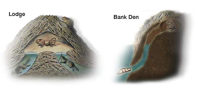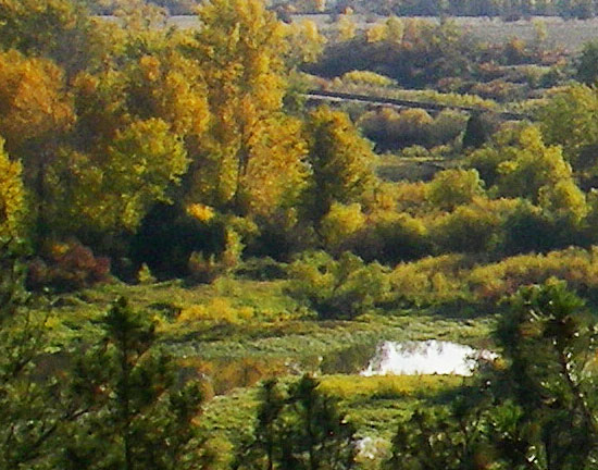


Good, secure den sites for beaver provide escape cover, resting and grooming areas, protection from predation, thermal protection during winter, and safe places for kit rearing. But just like humans, beavers build different kinds of homes. A study on beaver living on the Lower Flathead River identified three types of beaver houses.
• Bank dens — dens excavated into the river bank with an underwater entrance leading to an underground chamber (except during low flows, these dens can be very difficult to detect);
• Lodges — free-standing structures surrounded by water and constructed out of branches and mud;
• Stick-bank dens — hybrids of bank dens and lodges, usually these consist of a large stick and mud structure built against the river bank that covers chambers excavated into the bank;
• Other — dens that do not fit into the other three categories and are constructed out of riprap, built within culverts, or beneath fallen trees.
In the beaver study on the Lower Flathead, bank dens were the most numerous type of den. Stick-bank dens and lodges are difficult to maintain on a large river like the lower Flathead where high flows can destroy these dens by dislodging and washing them downstream. All active lodges were located in side channels where river flows were moderated. Stick-bank dens were generally located in deep, slow-moving eddies where they were protected from the main current behind point bars or rock outcrops. Even though bank dens were the most numerous, beaver preferred stick-bank dens and lodges. Both types of structures served as important winter colony sites and were important dens during low flows. During high flows when lodges and stick-bank dens flooded, beaver used bank dens or old lodges located in dry river channels or on high ground. In general, beavers favored areas with deep water, low velocities, and fine substrates for digging. Most homes had entrances at several water levels so the beavers can always enter underwater.