
History
The History of Fire and the Human Use of Fire in the Northern Rockies
History
The History of Fire and the Human Use of Fire in the Northern Rockies
History
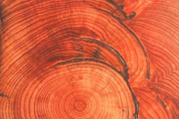
The History of Fire in the Northern Rockies
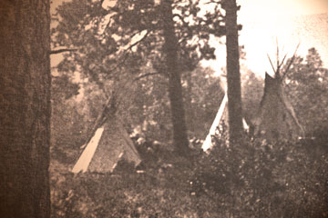
Traditional Life Cycle
The Traditional Life Cycle
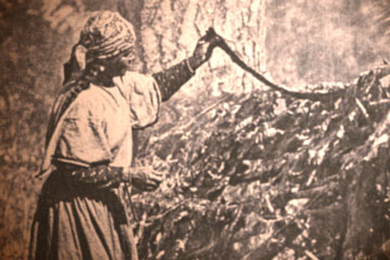
Before the last 150 years, Salish and Pend d’Oreille people did not practice agriculture, and they did not raise domesticated animals other than dogs (and in more recent centuries, horses). They subsisted solely on wild game, fish, and plants. They lived as tribes, doing many things communally or in family groups. Tribal people owned little personal property, and there was no concept of individual ownership of land. The people gathered enough food and medicine and material things for their own use and perhaps a little to exchange with others. This was an economic system based more on subsistence need than profit motive, a system profoundly different from what predominates today. And that overarching structure of Salish-Pend d'Oreille life, that cultural and economic and social system, helped determine the way that tribal people shaped and took care of the forests and grasslands through the use of fire.
Like most tribal hunter-fisher-gatherers around the world, the Salish and Pend d’Oreille had an intimate understanding of their territory and its resources, and they drew upon that extremely detailed body of knowledge to ensure a stable and reliable sustenance. They did not wander randomly across their vast lands as some early non-Indians thought. Rather, they had a widespread and ancient network of trails and thousands of placenames identifying specific areas. They also were not simply the passive recipients of the foods of nature, as many of the strangers and visitors assumed. Tribal people knew in great detail which foods or medicines or materials could be reliably harvested at which places, at which times of year, and by which methods. They had an elegant technology perfectly suited to these tasks. And of course, one of their most powerful tools was fire, and they systematically used this tool to nurture and sustain the resources that nurtured and sustained them.
In each of these seasons of the year, across all the varied lands of Salish and Pend d’Oreille territory, the people used fire as an integral part of that traditional way of life — one of the most sustainable and stable ways of life the world has ever seen.
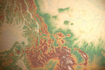
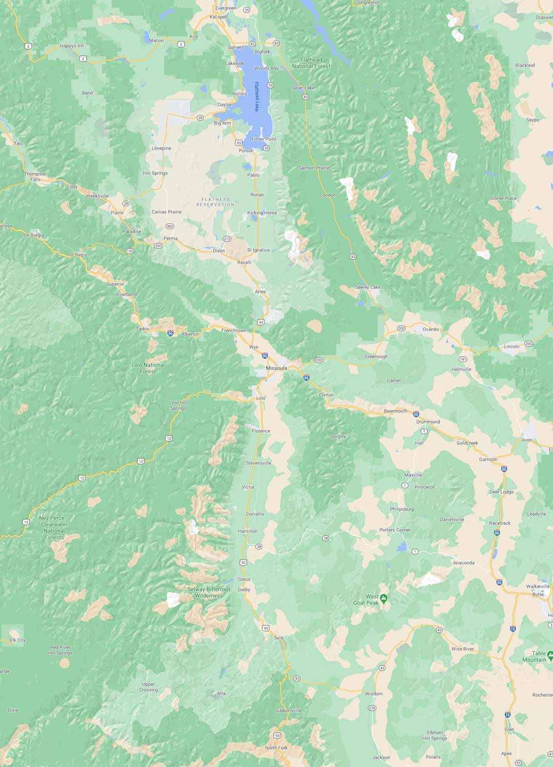
Traditional Territory
The Traditional Territory
The Ql̓ispé (Kalispel or Pend d’Oreille) are close relations and neighbors of the Salish, and speak a closely related dialect of the Salish language. They were traditionally organized in a number of bands based in the vast drainage system of the Clark’s Fork River, ranging from the numerous forks of the Flathead River and the Flathead Lake area downstream to the Lower Clark’s Fork, Lake Pend d’Oreille and the Pend d’Oreille River.
There was also a related tribe of the Salishan family called the Tun̓áx̣n that lived east of the Continental Divide, along the Rocky Mountain Front. They were later virtually eliminated by epidemics of smallpox.
All of these tribes utilized a far larger area for hunting, fishing, and gathering plants. Buffalo hunting parties often ventured east of present day Billings, north to Canada, and south to Wyoming, all areas that they regarded as common hunting grounds. Fishing, gathering, and trading parties have always ventured west into what is now Washington state. Indeed, Elders tell of how the tribes of the Salish language family, stretching west all the way to the Pacific Coast, were in the distant past one nation, and that is why to this day they are friends, allies, and relations of the Montana Salishan tribes.
And as we will see, for millennia, much of this sprawling territory was actively managed by the tribes through the frequent use of fire.

How Long?
How Long Have the Tribes Been Here?

In the traditional stories, Coyote prepared this land for the Salish and Pend d’Oreille, and he left behind land marks to remind the people of his deeds. Throughout the immense Salish-Pend d’Oreille aboriginal territory, many of the land formations — even entire valleys, rivers, mountains, and lakes — are tied to these ancient stories of creation and transformation. In this sense, the legends of Coyote and the other animal people provide us with clues about how long the people have been here. For in the stories themselves, we can find uncanny descriptions of what non-Indian geologists also say happened during the last ice age: the extension of the glaciers down what is now Flathead Lake, the flooding of western Montana beneath a great lake (now referred to as Glacial Lake Missoula), and the breaking up of the ice dam that contained those waters. The stories tell of the gradual retreat, advance, and then final retreat of the bitter cold weather as the ice age came to an end. They also describe the disappearance of large animals like giant beaver and wooly mammoths, and their replacement by the present-day smaller versions of those creatures. Archaeologists have documented sites within the aboriginal territory that corroborate these stories, reflecting a continuous tribal occupancy reaching back to about the time of the end of the last ice age.
That is a long time to live in one place. It is a long time for a people to learn at the deepest level about the land, the waters, the plants, and animals, about their cycles of scarcity and abundance over both short and long periods of time. It is partly through that long tenure, and through the integrity and fidelity of their oral traditions that passed teachings down from generation to generation, that Salish and Pend d’Oreille people were able to master the use of fire, to learn how to use it in a largely beneficial way.

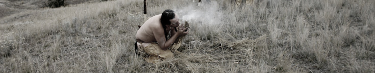
Sxwpaam
Sx͏ʷpaam: The One Who Makes Fire
Among the Kootenai people of British Columbia, elders said that the same kind of care was taken, with coals placed within ashes and carried on sticks for short journeys, or “placed within the halves of a clam” for longer trips. There were also ways of restarting fire when necessary, using drills or flint, but when possible, the sx͏ʷpaam and people in camp tended the fire and kept it alive. Among the Kootenai, the fire-keeper maintained two special bags — one to keep tinder from a tree fungus that could easily ignite a spark from a drill, the other for a certain kind of dead wood that could then receive the glowing fungus.
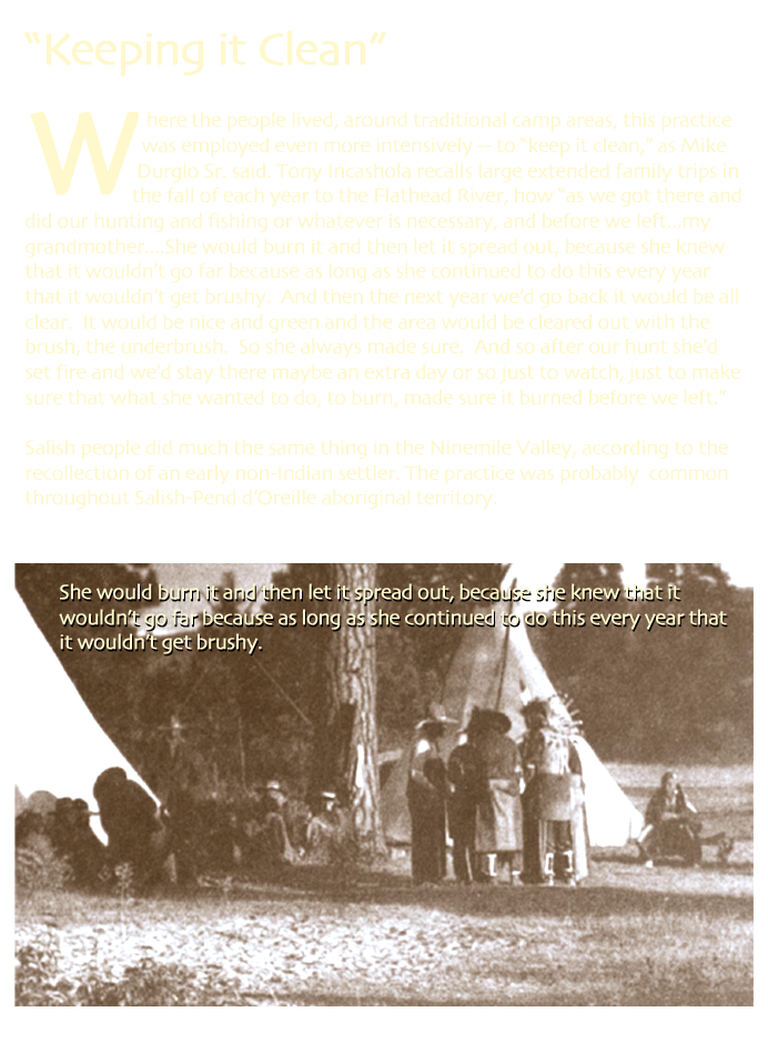
The sx͏ʷpaam was as careful in using fire on the land as he was in keeping the ember burning in traveling between camps. “They didn’t burn things just indiscriminately,” Salish elder Louie Adams pointed out. The elders have given a clear understanding that the people carefully “used the fire like a tool,” as Pend d’Oreille elder Mike Durglo Sr. put it.
Of course, accidents sometimes happened; sometimes there were uncontrolled, destructive fires long ago, just as there are today, and sometimes those fires were the result of human error, just as they are today. But that was not the norm. As with so many other aspects of the traditional way of life, the use of fire was in part based on careful, quiet, long observation of the natural world, on discerning what was of benefit, and what was harmful. “My grandparents and other old people have said you [must] pay attention,” says Tony Incashola, Director of the Salish-Pend d’Oreille Culture Committee. “Pay attention to the animals, pay attention to the plants, pay attention to these things and you’ll know what the needs are. You watch an animal... and...you see how it lives; you see what the needs are and then you see how nature takes care of it. Once you learn that, then the Indian people copy that, they do that. And then they learn that and then they pass it on.”
Some of the deeper specific knowledge of how fire was used may have been lost in the traumatic disruptions of tribal culture and oral traditions over the past century. But the elders remember enough to help us understand the basic relationship with fire, and the function that it served within the traditional way of life.


Reasons for Burning
Reasons For Burning
Salish and Pend d’Oreille people burned for dozens of reasons. Here we describe some of them as described by Salish and Pend d'Oreille elders. Click on one of the tabs to learn more about why fire was used as a tool.
Clearing Brush
Beauty

Cleaning
Trails

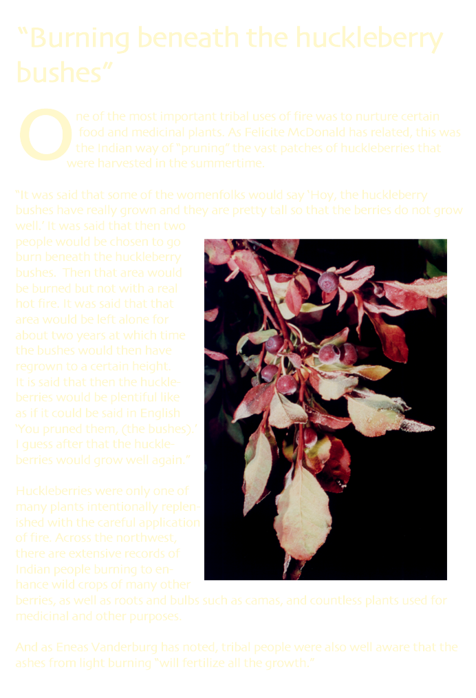
Berries

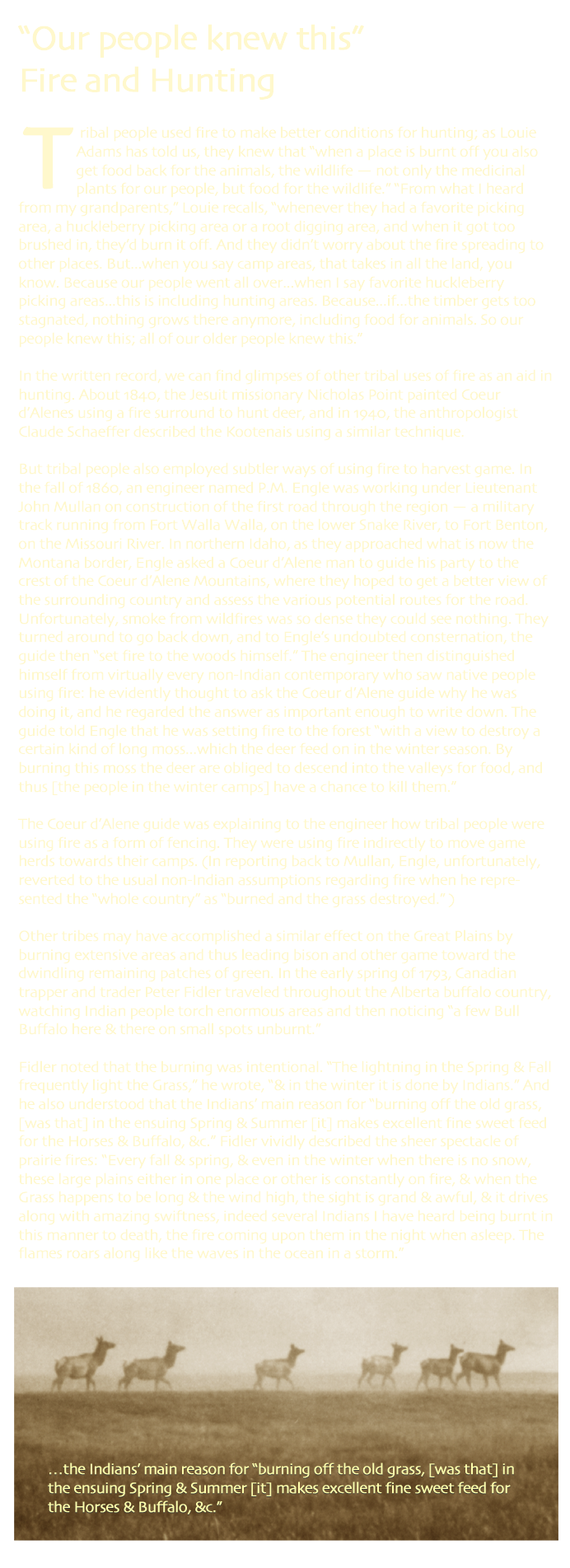
Hunting

Horses
Signaling

Fire History
Cultural Geography
A Cultural Geography of Fire: Tribal Placenames and Fire
As we have seen, fire was the most powerful tool by which Salish and Pend d’Oreille shaped their land — and on a scale that was scarcely imagined by early non-Indians. It is also difficult to imagine today. The repression of fire and the tribal use of fire has dramatically changed many of the fire-shaped landscapes that once characterized western Montana. That repression has also diminished the tribal knowledge of how and where fire was used.
In this website we have made use of a wide range of sources to help us better understand that vanished landscape: tribal elders, tribal oral literature, early archival records such as fur trade journals, and scientific research on old growth trees.
But there is another technique that in some ways provides us with a more direct access to the fire-shaped world of traditional tribal life. Linguists say that many of the traditional place-names are among the oldest words in the Salish language, some of them even incorporate words or particles from proto-Salish or now extinct Salishan dialects. Because many of these placenames contain descriptions of the land, a number of them offer testimony to the old fire-shaped landscape of western Montana.
Click on a map pin to read about some of these landscapes.

Npp̓aá
Location: along Swan River near Condon. This placename means “Burned-Over Ground.” Non-Indians called it “Squaw Flats.” A typical fire-created meadow area in the Swan Valley, it is in the heart of traditional Pend d’Oreille territory. When a game warden killed four members of a small Pend d’Oreille hunting camp in the Swan Massacre of 1908, a survivor rode for help and found other people camped at Npp̓aá.
Ɫl̓q͏ʷl̓q͏ʷo
Location: Murphy Flats-Big Prairie area along South Fork Flathead River in the Bob Marshall Wilderness. This placename means "Many Little Prairies" — the classic mosaic pattern created in ponderosa ecosystems by frequent low-intensity fires. As Salish elder Louie Adams has told us, Ɫlq͏ʷlq͏ʷoã means “a big open area with big ponderosa pine trees that are three, four, five hundred years old...most are scarred where our Indians got food from them...[this]was one area that the Indians burnt off quite a lot so the grass would come back... not only for their livestock but for the wild creatures.”
X̣qcné
Location: in present area of Double Arrow Ranch, east side of Hwy 83 just south of Seeley Lake. This place-name means “Open area by the water.” Salish elder Felicite McDonald often stayed with her family at this place while they were on their fall hunting trips near Seeley Lake. It is a good example of a name referring to the small open areas or “prairies” created and maintained by regular burning that were once common in the forested valleys of western Montana. Like many others, this “open area” has now largely disappeared.
Eslq̓͏ʷólex͏ʷ
Location: Flats between East Missoula and Marshall Creek. This placename means Open Ground between Trees or Hills. It refers to the flat grassland between what is now East Missoula and Marshall Creek — another area that tribal people maintained and re-newed with fire. This was one of the most important winter grazing areas in the region, along with Horse Plains and Valley Creek.
Člmé
Location: Council Grove, just west of Missoula. This is the placename for Council Grove, just west of Missoula, where tribal leaders and U.S. Government officials negotiated and signed the Hellgate Treaty in July 1855. The name Člmé means Tree Limb Cut Off — referring to the old fire-resistant ponderosa pines, still there today, that typically have no branches on their lower trunks.
Snpƛ̓mqné
Location: Ninemile Prairie on north side of Blackfoot River near Potomac. This placename means Coming to the Forested Edge of an Open Flat. It is located on Ninemile Prairie on the north side of the Blackfoot River, and is another open place probably once maintained with fire. When Agnes Pokerjim Paul camped there in 1928, when she was 18 years old, she remembered a straight row of old ponderosa pines in the center of the flats. She didn’t return for 73 years — but she found the pines still there.
Čpaaqn
Location: Morrison Mountain, due north of Potomac. This placename means Grayish Peak, called that because it was bare on top. It is a good example of how the environment has changed in the absence of fire.
Today this place, called Morrison Mountain, is completely forested except for a clearcut on one side. Elders remember that long ago, when they would be camped at the Potomac area digging camas, they could hear wolves howling on Čpaaqn — another change of the last century.
Nccq̓ɫpé
This place-name refers to Blue Mountain, and the long form, Nccq̓ɫpétk͏ʷ, refers to Deadman Gulch, which flows into the Bitterroot River across from the mouth of Miller Creek. This placename means Place of the Douglas Fir Trees. Linguistically, the name seems to suggest there were a lot of Douglas firs. There is no equivalent Salish placename in western Montana referring to more fire resistant pond-erosa pines, which were far more common under native fire regimes. So perhaps this placename is a reflection of how relatively unusual Douglas firs were before fire suppression.
Ɫq̓éɫml̓š
Location: Stevensville area. This placename means Wide Place of Cottonwoods, referring to what is now the Stevensville area, the most important winter camp for the Salish people in the Bitterroot Valley. Many early visitors wrote about how open and prairie-like the Bitterroot was and how frequent the Indian fires were. Many of the Salish placenames for the valley, including this one, refer to the places where there were groves of trees – in this case, cottonwoods. Today, it is the prairies and open places that are more uncommon.
X̣cx̣clex͏ʷé
Location: Victor. This placename means Clear a Underbrush — a perfect description, in one vivid Salish word, of the typical tribal fire-shaped land scape in western Montana. X̣cx̣clex͏ʷé refers to the area of what is now Victor, Montana.
Ɫlq̓͏ʷo
Location : Magruder Ranger Station on Selway River just over Nez Perce Pass from Montana. Ɫlq̓͏ʷo means Little Prairie, and it refers to the area near what is now the Magruder Ranger Station, along the Selway River in Idaho, just across Nez Perce Pass from Montana. It is a thickly forested area and this was clearly a prairie created through the use of fire. It was located along one of the most heavily used native trails in the Bitterroots.

Traditional Life Cycle
The Traditional Life Cycle
Before the last 150 years, Salish and Pend d’Oreille people did not practice agriculture, and they did not raise domesticated animals other than dogs (and in more recent centuries, horses). They subsisted solely on wild game, fish, and plants. They lived as tribes, doing many things communally or in family groups. Tribal people owned little personal property, and there was no concept of individual ownership of land. The people gathered enough food and medicine and material things for their own use and perhaps a little to exchange with others. This was an economic system based more on subsistence need than profit motive, a system profoundly different from what predominates today. And that overarching structure of Salish-Pend d'Oreille life, that cultural and economic and social system, helped determine the way that tribal people shaped and took care of the forests and grasslands through the use of fire.
Like most tribal hunter-fisher-gatherers around the world, the Salish and Pend d’Oreille had an intimate understanding of their territory and its resources, and they drew upon that extremely detailed body of knowledge to ensure a stable and reliable sustenance. They did not wander randomly across their vast lands as some early non-Indians thought. Rather, they had a widespread and ancient network of trails and thousands of placenames identifying specific areas. They also were not simply the passive recipients of the foods of nature, as many of the strangers and visitors assumed. Tribal people knew in great detail which foods or medicines or materials could be reliably harvested at which places, at which times of year, and by which methods. They had an elegant technology perfectly suited to these tasks. And of course, one of their most powerful tools was fire, and they systematically used this tool to nurture and sustain the resources that nurtured and sustained them.
In each of these seasons of the year, across all the varied lands of Salish and Pend d’Oreille territory, the people used fire as an integral part of that traditional way of life — one of the most sustainable and stable ways of life the world has ever seen.

Traditional Territory
The Traditional Territory
The Ql̓ispé (Kalispel or Pend d’Oreille) are close relations and neighbors of the Salish, and speak a closely related dialect of the Salish language. They were traditionally organized in a number of bands based in the vast drainage system of the Clark’s Fork River, ranging from the numerous forks of the Flathead River and the Flathead Lake area downstream to the Lower Clark’s Fork, Lake Pend d’Oreille and the Pend d’Oreille River.
There was also a related tribe of the Salishan family called the Tun̓áx̣n that lived east of the Continental Divide, along the Rocky Mountain Front. They were later virtually eliminated by epidemics of smallpox.
All of these tribes utilized a far larger area for hunting, fishing, and gathering plants. Buffalo hunting parties often ventured east of present day Billings, north to Canada, and south to Wyoming, all areas that they regarded as common hunting grounds. Fishing, gathering, and trading parties have always ventured west into what is now Washington state. Indeed, Elders tell of how the tribes of the Salish language family, stretching west all the way to the Pacific Coast, were in the distant past one nation, and that is why to this day they are friends, allies, and relations of the Montana Salishan tribes.
And as we will see, for millennia, much of this sprawling territory was actively managed by the tribes through the frequent use of fire.

How Long?
How Long Have the Tribes Been Here?
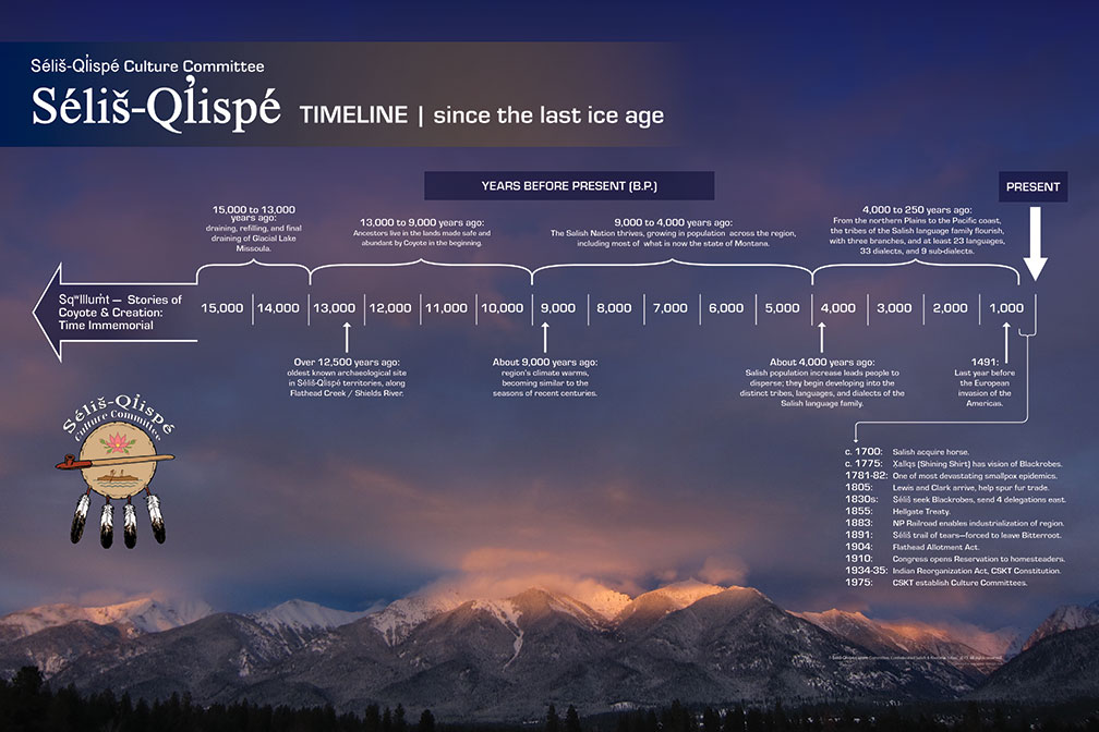
In the traditional stories, Coyote prepared this land for the Salish and Pend d’Oreille, and he left behind land marks to remind the people of his deeds. Throughout the immense Salish-Pend d’Oreille aboriginal territory, many of the land formations — even entire valleys, rivers, mountains, and lakes — are tied to these ancient stories of creation and transformation. In this sense, the legends of Coyote and the other animal people provide us with clues about how long the people have been here. For in the stories themselves, we can find uncanny descriptions of what non-Indian geologists also say happened during the last ice age: the extension of the glaciers down what is now Flathead Lake, the flooding of western Montana beneath a great lake (now referred to as Glacial Lake Missoula), and the breaking up of the ice dam that contained those waters. The stories tell of the gradual retreat, advance, and then final retreat of the bitter cold weather as the ice age came to an end. They also describe the disappearance of large animals like giant beaver and wooly mammoths, and their replacement by the present-day smaller versions of those creatures. Archaeologists have documented sites within the aboriginal territory that corroborate these stories, reflecting a continuous tribal occupancy reaching back to about the time of the end of the last ice age.
That is a long time to live in one place. It is a long time for a people to learn at the deepest level about the land, the waters, the plants, and animals, about their cycles of scarcity and abundance over both short and long periods of time. It is partly through that long tenure, and through the integrity and fidelity of their oral traditions that passed teachings down from generation to generation, that Salish and Pend d’Oreille people were able to master the use of fire, to learn how to use it in a largely beneficial way.
Sxwpaam
Sx͏ʷpaam: The One Who Makes Fire
Among the Kootenai people of British Columbia, elders said that the same kind of care was taken, with coals placed within ashes and carried on sticks for short journeys, or “placed within the halves of a clam” for longer trips. There were also ways of restarting fire when necessary, using drills or flint, but when possible, the sx͏ʷpaam and people in camp tended the fire and kept it alive. Among the Kootenai, the fire-keeper maintained two special bags — one to keep tinder from a tree fungus that could easily ignite a spark from a drill, the other for a certain kind of dead wood that could then receive the glowing fungus.
The sx͏ʷpaam was as careful in using fire on the land as he was in keeping the ember burning in traveling between camps. “They didn’t burn things just indiscriminately,” Salish elder Louie Adams pointed out. The elders have given a clear understanding that the people carefully “used the fire like a tool,” as Pend d’Oreille elder Mike Durglo Sr. put it.
Of course, accidents sometimes happened; sometimes there were uncontrolled, destructive fires long ago, just as there are today, and sometimes those fires were the result of human error, just as they are today. But that was not the norm. As with so many other aspects of the traditional way of life, the use of fire was in part based on careful, quiet, long observation of the natural world, on discerning what was of benefit, and what was harmful. “My grandparents and other old people have said you [must] pay attention,” says Tony Incashola, Director of the Salish-Pend d’Oreille Culture Committee. “Pay attention to the animals, pay attention to the plants, pay attention to these things and you’ll know what the needs are. You watch an animal... and...you see how it lives; you see what the needs are and then you see how nature takes care of it. Once you learn that, then the Indian people copy that, they do that. And then they learn that and then they pass it on.”
Some of the deeper specific knowledge of how fire was used may have been lost in the traumatic disruptions of tribal culture and oral traditions over the past century. But the elders remember enough to help us understand the basic relationship with fire, and the function that it served within the traditional way of life.


Reasons for Burning
Reasons For Burning
Salish and Pend d’Oreille people burned for dozens of reasons. Here we describe some of them as described by Salish and Pend d'Oreille elders. Click on one of the tabs to learn more about why fire was used as a tool.
Clearing Brush
Beauty
Cleaning

Trails
Berries

Hunting

Horses

Signaling

Fire History


Cultural Geography
A Cultural Geography of Fire: Tribal Placenames and Fire
As we have seen, fire was the most powerful tool by which Salish and Pend d’Oreille shaped their land — and on a scale that was scarcely imagined by early non-Indians. It is also difficult to imagine today. The repression of fire and the tribal use of fire has dramatically changed many of the fire-shaped landscapes that once characterized western Montana. That repression has also diminished the tribal knowledge of how and where fire was used.
In this website we have made use of a wide range of sources to help us better understand that vanished landscape: tribal elders, tribal oral literature, early archival records such as fur trade journals, and scientific research on old growth trees.
But there is another technique that in some ways provides us with a more direct access to the fire-shaped world of traditional tribal life. Linguists say that many of the traditional place-names are among the oldest words in the Salish language, some of them even incorporate words or particles from proto-Salish or now extinct Salishan dialects. Because many of these placenames contain descriptions of the land, a number of them offer testimony to the old fire-shaped landscape of western Montana. Click on a map pin to read about some of these landscapes.
Npp̓aá
Along Swan River near Condon. This placename means “Burned-Over Ground.” A typical fire-created meadow area in the Swan Valley, it is in the heart of traditional Pend d’Oreille territory. When a game warden killed four members of a small Pend d’Oreille hunting camp in the Swan Massacre of 1908, a survivor rode for help and found other people camped at Npp̓aá. Thanks to the efforts of the Salish-Pend d'Oreille Culture Committee and Elders Advisory Council, this name has now been restored to the land. For more than a century, non-Indians called the area “Squaw Flats" and the stream here "Squaw Creek." In 2008, the US Board of Geographic Names approved the renaming of the stream as "In-pa-ah Creek".
Ɫl̓q͏ʷl̓q͏ʷo
Location: Murphy Flats-Big Prairie area along South Fork Flathead River in the Bob Marshall Wilderness. This placename means "Many Little Prairies" — the classic mosaic pattern created in ponderosa ecosystems by frequent low-intensity fires. As Salish elder Louie Adams has told us, Ɫlq͏ʷlq͏ʷoã means “a big open area with big ponderosa pine trees that are three, four, five hundred years old...most are scarred where our Indians got food from them...[this]was one area that the Indians burnt off quite a lot so the grass would come back... not only for their livestock but for the wild creatures.”
X̣qcné
Location: in present area of Double Arrow Ranch, east side of Hwy 83 just south of Seeley Lake. This place-name means “Open area by the water.” Salish elder Felicite McDonald often stayed with her family at this place while they were on their fall hunting trips near Seeley Lake. It is a good example of a name referring to the small open areas or “prairies” created and maintained by regular burning that were once common in the forested valleys of western Montana. Like many others, this “open area” has now largely disappeared.
Eslq̓͏ʷólex͏ʷ
Location: Flats between East Missoula and Marshall Creek. This placename means Open Ground between Trees or Hills. It refers to the flat grassland between what is now East Missoula and Marshall Creek — another area that tribal people maintained and re-newed with fire. This was one of the most important winter grazing areas in the region, along with Horse Plains and Valley Creek.
Člmé
Location: Council Grove, just west of Missoula. This is the placename for Council Grove, just west of Missoula, where tribal leaders and U.S. Government officials negotiated and signed the Hellgate Treaty in July 1855. The name Člmé means Tree Limb Cut Off — referring to the old fire-resistant ponderosa pines, still there today, that typically have no branches on their lower trunks.
Snpƛ̓mqné
Location: Ninemile Prairie on north side of Blackfoot River near Potomac. This placename means Coming to the Forested Edge of an Open Flat. It is located on Ninemile Prairie on the north side of the Blackfoot River, and is another open place probably once maintained with fire. When Agnes Pokerjim Paul camped there in 1928, when she was 18 years old, she remembered a straight row of old ponderosa pines in the center of the flats. She didn’t return for 73 years — but she found the pines still there.
Čpaaqn
Location: Morrison Mountain, due north of Potomac. This placename means Grayish Peak, called that because it was bare on top. It is a good example of how the environment has changed in the absence of fire.
Today this place, called Morrison Mountain, is completely forested except for a clearcut on one side. Elders remember that long ago, when they would be camped at the Potomac area digging camas, they could hear wolves howling on Čpaaqn — another change of the last century.
Nccq̓ɫpé
This place-name refers to Blue Mountain, and the long form, Nccq̓ɫpétk͏ʷ, refers to Deadman Gulch, which flows into the Bitterroot River across from the mouth of Miller Creek. This placename means Place of the Douglas Fir Trees. Linguistically, the name seems to suggest there were a lot of Douglas firs. There is no equivalent Salish placename in western Montana referring to more fire resistant pond-erosa pines, which were far more common under native fire regimes. So perhaps this placename is a reflection of how relatively unusual Douglas firs were before fire suppression.
Ɫq̓éɫml̓š
Location: Stevensville area. This placename means Wide Place of Cottonwoods, referring to what is now the Stevensville area, the most important winter camp for the Salish people in the Bitterroot Valley. Many early visitors wrote about how open and prairie-like the Bitterroot was and how frequent the Indian fires were. Many of the Salish placenames for the valley, including this one, refer to the places where there were groves of trees – in this case, cottonwoods. Today, it is the prairies and open places that are more uncommon.
X̣cx̣clex͏ʷé
Location: Victor. This placename means Clear a Underbrush — a perfect description, in one vivid Salish word, of the typical tribal fire-shaped land scape in western Montana. X̣cx̣clex͏ʷé refers to the area of what is now Victor, Montana.
Ɫlq̓͏ʷo
Location : Magruder Ranger Station on Selway River just over Nez Perce Pass from Montana. Ɫlq̓͏ʷo means Little Prairie, and it refers to the area near what is now the Magruder Ranger Station, along the Selway River in Idaho, just across Nez Perce Pass from Montana. It is a thickly forested area and this was clearly a prairie created through the use of fire. It was located along one of the most heavily used native trails in the Bitterroots.

Traditional Life Cycle
The Traditional Life Cycle
Before the last 150 years, Salish and Pend d’Oreille people did not practice agriculture, and they did not raise domesticated animals other than dogs (and in more recent centuries, horses). They subsisted solely on wild game, fish, and plants. They lived as tribes, doing many things communally or in family groups. Tribal people owned little personal property, and there was no concept of individual ownership of land. The people gathered enough food and medicine and material things for their own use and perhaps a little to exchange with others. This was an economic system based more on subsistence need than profit motive, a system profoundly different from what predominates today. And that overarching structure of Salish-Pend d'Oreille life, that cultural and economic and social system, helped determine the way that tribal people shaped and took care of the forests and grasslands through the use of fire.
Like most tribal hunter-fisher-gatherers around the world, the Salish and Pend d’Oreille had an intimate understanding of their territory and its resources, and they drew upon that extremely detailed body of knowledge to ensure a stable and reliable sustenance. They did not wander randomly across their vast lands as some early non-Indians thought. Rather, they had a widespread and ancient network of trails and thousands of placenames identifying specific areas. They also were not simply the passive recipients of the foods of nature, as many of the strangers and visitors assumed. Tribal people knew in great detail which foods or medicines or materials could be reliably harvested at which places, at which times of year, and by which methods. They had an elegant technology perfectly suited to these tasks. And of course, one of their most powerful tools was fire, and they systematically used this tool to nurture and sustain the resources that nurtured and sustained them.
In each of these seasons of the year, across all the varied lands of Salish and Pend d’Oreille territory, the people used fire as an integral part of that traditional way of life — one of the most sustainable and stable ways of life the world has ever seen.

Traditional Territory
The Traditional Territory
The Ql̓ispé (Kalispel or Pend d’Oreille) are close relations and neighbors of the Salish, and speak a closely related dialect of the Salish language. They were traditionally organized in a number of bands based in the vast drainage system of the Clark’s Fork River, ranging from the numerous forks of the Flathead River and the Flathead Lake area downstream to the Lower Clark’s Fork, Lake Pend d’Oreille and the Pend d’Oreille River.
There was also a related tribe of the Salishan family called the Tun̓áx̣n that lived east of the Continental Divide, along the Rocky Mountain Front. They were later virtually eliminated by epidemics of smallpox.
All of these tribes utilized a far larger area for hunting, fishing, and gathering plants. Buffalo hunting parties often ventured east of present day Billings, north to Canada, and south to Wyoming, all areas that they regarded as common hunting grounds. Fishing, gathering, and trading parties have always ventured west into what is now Washington state. Indeed, Elders tell of how the tribes of the Salish language family, stretching west all the way to the Pacific Coast, were in the distant past one nation, and that is why to this day they are friends, allies, and relations of the Montana Salishan tribes.
And as we will see, for millennia, much of this sprawling territory was actively managed by the tribes through the frequent use of fire.
How Long?
How Long Have the Tribes Been Here?

In the traditional stories, Coyote prepared this land for the Salish and Pend d’Oreille, and he left behind land marks to remind the people of his deeds. Throughout the immense Salish-Pend d’Oreille aboriginal territory, many of the land formations — even entire valleys, rivers, mountains, and lakes — are tied to these ancient stories of creation and transformation. In this sense, the legends of Coyote and the other animal people provide us with clues about how long the people have been here. For in the stories themselves, we can find uncanny descriptions of what non-Indian geologists also say happened during the last ice age: the extension of the glaciers down what is now Flathead Lake, the flooding of western Montana beneath a great lake (now referred to as Glacial Lake Missoula), and the breaking up of the ice dam that contained those waters. The stories tell of the gradual retreat, advance, and then final retreat of the bitter cold weather as the ice age came to an end. They also describe the disappearance of large animals like giant beaver and wooly mammoths, and their replacement by the present-day smaller versions of those creatures. Archaeologists have documented sites within the aboriginal territory that corroborate these stories, reflecting a continuous tribal occupancy reaching back to about the time of the end of the last ice age.
That is a long time to live in one place. It is a long time for a people to learn at the deepest level about the land, the waters, the plants, and animals, about their cycles of scarcity and abundance over both short and long periods of time. It is partly through that long tenure, and through the integrity and fidelity of their oral traditions that passed teachings down from generation to generation, that Salish and Pend d’Oreille people were able to master the use of fire, to learn how to use it in a largely beneficial way.

Sxwpaam
Sx͏ʷpaam: The One Who Makes Fire
Among the Kootenai people of British Columbia, elders said that the same kind of care was taken, with coals placed within ashes and carried on sticks for short journeys, or “placed within the halves of a clam” for longer trips. There were also ways of restarting fire when necessary, using drills or flint, but when possible, the sx͏ʷpaam and people in camp tended the fire and kept it alive. Among the Kootenai, the fire-keeper maintained two special bags — one to keep tinder from a tree fungus that could easily ignite a spark from a drill, the other for a certain kind of dead wood that could then receive the glowing fungus.
The sx͏ʷpaam was as careful in using fire on the land as he was in keeping the ember burning in traveling between camps. “They didn’t burn things just indiscriminately,” Salish elder Louie Adams pointed out. The elders have given a clear understanding that the people carefully “used the fire like a tool,” as Pend d’Oreille elder Mike Durglo Sr. put it.
Of course, accidents sometimes happened; sometimes there were uncontrolled, destructive fires long ago, just as there are today, and sometimes those fires were the result of human error, just as they are today. But that was not the norm. As with so many other aspects of the traditional way of life, the use of fire was in part based on careful, quiet, long observation of the natural world, on discerning what was of benefit, and what was harmful. “My grandparents and other old people have said you [must] pay attention,” says Tony Incashola, Director of the Salish-Pend d’Oreille Culture Committee. “Pay attention to the animals, pay attention to the plants, pay attention to these things and you’ll know what the needs are. You watch an animal... and...you see how it lives; you see what the needs are and then you see how nature takes care of it. Once you learn that, then the Indian people copy that, they do that. And then they learn that and then they pass it on.”
Some of the deeper specific knowledge of how fire was used may have been lost in the traumatic disruptions of tribal culture and oral traditions over the past century. But the elders remember enough to help us understand the basic relationship with fire, and the function that it served within the traditional way of life.
Reasons for Burning
Reasons For Burning
Salish and Pend d’Oreille people burned for dozens of reasons. Here we describe some of them as described by Salish and Pend d'Oreille elders. Click on one of the tabs to learn more about why fire was used as a tool.
Clearing Brush

Beauty

Cleaning

Trails

Berries
Hunting
Horses

Signaling


Fire History


Cultural Geography
A Cultural Geography of Fire: Tribal Placenames and Fire
As we have seen, fire was the most powerful tool by which Salish and Pend d’Oreille shaped their land — and on a scale that was scarcely imagined by early non-Indians. It is also difficult to imagine today. The repression of fire and the tribal use of fire has dramatically changed many of the fire-shaped landscapes that once characterized western Montana. That repression has also diminished the tribal knowledge of how and where fire was used.
In this website we have made use of a wide range of sources to help us better understand that vanished landscape: tribal elders, tribal oral literature, early archival records such as fur trade journals, and scientific research on old growth trees.
But there is another technique that in some ways provides us with a more direct access to the fire-shaped world of traditional tribal life. Linguists say that many of the traditional place-names are among the oldest words in the Salish language, some of them even incorporate words or particles from proto-Salish or now extinct Salishan dialects. Because many of these placenames contain descriptions of the land, a number of them offer testimony to the old fire-shaped landscape of western Montana. Click on a map pin to read about some of these landscapes.

Npp̓aá
Along Swan River near Condon. This placename means “Burned-Over Ground.” A typical fire-created meadow area in the Swan Valley, it is in the heart of traditional Pend d’Oreille territory. When a game warden killed four members of a small Pend d’Oreille hunting camp in the Swan Massacre of 1908, a survivor rode for help and found other people camped at Npp̓aá. Thanks to the efforts of the Salish-Pend d'Oreille Culture Committee and Elders Advisory Council, this name has now been restored to the land. For more than a century, non-Indians called the area “Squaw Flats" and the stream here "Squaw Creek." In 2008, the US Board of Geographic Names approved the renaming of the stream as "In-pa-ah Creek".
Ɫl̓q͏ʷl̓q͏ʷo
Location: Murphy Flats-Big Prairie area along South Fork Flathead River in the Bob Marshall Wilderness. This placename means "Many Little Prairies" — the classic mosaic pattern created in ponderosa ecosystems by frequent low-intensity fires. As Salish elder Louie Adams has told us, Ɫlq͏ʷlq͏ʷoã means “a big open area with big ponderosa pine trees that are three, four, five hundred years old...most are scarred where our Indians got food from them...[this]was one area that the Indians burnt off quite a lot so the grass would come back... not only for their livestock but for the wild creatures.”
X̣qcné
Location: in present area of Double Arrow Ranch, east side of Hwy 83 just south of Seeley Lake. This place-name means “Open area by the water.” Salish elder Felicite McDonald often stayed with her family at this place while they were on their fall hunting trips near Seeley Lake. It is a good example of a name referring to the small open areas or “prairies” created and maintained by regular burning that were once common in the forested valleys of western Montana. Like many others, this “open area” has now largely disappeared.
Eslq̓͏ʷólex͏ʷ
Location: Flats between East Missoula and Marshall Creek. This placename means Open Ground between Trees or Hills. It refers to the flat grassland between what is now East Missoula and Marshall Creek — another area that tribal people maintained and re-newed with fire. This was one of the most important winter grazing areas in the region, along with Horse Plains and Valley Creek.
Člmé
Location: Council Grove, just west of Missoula. This is the placename for Council Grove, just west of Missoula, where tribal leaders and U.S. Government officials negotiated and signed the Hellgate Treaty in July 1855. The name Člmé means Tree Limb Cut Off — referring to the old fire-resistant ponderosa pines, still there today, that typically have no branches on their lower trunks.
Snpƛ̓mqné
Location: Ninemile Prairie on north side of Blackfoot River near Potomac. This placename means Coming to the Forested Edge of an Open Flat. It is located on Ninemile Prairie on the north side of the Blackfoot River, and is another open place probably once maintained with fire. When Agnes Pokerjim Paul camped there in 1928, when she was 18 years old, she remembered a straight row of old ponderosa pines in the center of the flats. She didn’t return for 73 years — but she found the pines still there.
Čpaaqn
Location: Morrison Mountain, due north of Potomac. This placename means Grayish Peak, called that because it was bare on top. It is a good example of how the environment has changed in the absence of fire.
Today this place, called Morrison Mountain, is completely forested except for a clearcut on one side. Elders remember that long ago, when they would be camped at the Potomac area digging camas, they could hear wolves howling on Čpaaqn — another change of the last century.
Nccq̓ɫpé
This place-name refers to Blue Mountain, and the long form, Nccq̓ɫpétk͏ʷ, refers to Deadman Gulch, which flows into the Bitterroot River across from the mouth of Miller Creek. This placename means Place of the Douglas Fir Trees. Linguistically, the name seems to suggest there were a lot of Douglas firs. There is no equivalent Salish placename in western Montana referring to more fire resistant pond-erosa pines, which were far more common under native fire regimes. So perhaps this placename is a reflection of how relatively unusual Douglas firs were before fire suppression.
Ɫq̓éɫml̓š
Location: Stevensville area. This placename means Wide Place of Cottonwoods, referring to what is now the Stevensville area, the most important winter camp for the Salish people in the Bitterroot Valley. Many early visitors wrote about how open and prairie-like the Bitterroot was and how frequent the Indian fires were. Many of the Salish placenames for the valley, including this one, refer to the places where there were groves of trees – in this case, cottonwoods. Today, it is the prairies and open places that are more uncommon.
X̣cx̣clex͏ʷé
Location: Victor. This placename means Clear a Underbrush — a perfect description, in one vivid Salish word, of the typical tribal fire-shaped land scape in western Montana. X̣cx̣clex͏ʷé refers to the area of what is now Victor, Montana.
Ɫlq̓͏ʷo
Location : Magruder Ranger Station on Selway River just over Nez Perce Pass from Montana. Ɫlq̓͏ʷo means Little Prairie, and it refers to the area near what is now the Magruder Ranger Station, along the Selway River in Idaho, just across Nez Perce Pass from Montana. It is a thickly forested area and this was clearly a prairie created through the use of fire. It was located along one of the most heavily used native trails in the Bitterroots.
© 2021 Confederated Salish and Kootenai Tribes | Contact Us
© 2021 Confederated Salish and Kootenai Tribes | Contact Us